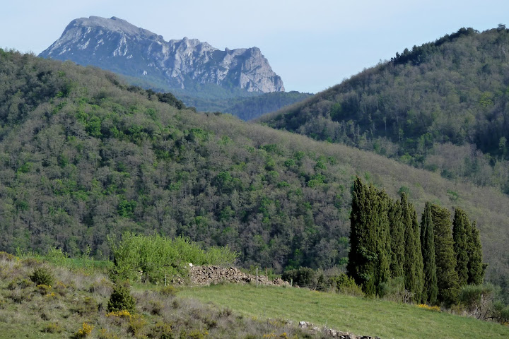
El miûˋrcoles estuve en Itxina. Y volvûÙ abducido. Realicûˋ una circular brutal desde Urigoiti para ascender a las cimas de Altipitatx, Ipergorta y Gorosteta. En el camino descubrûÙ la cascada de Aldabide, el canal de Sintxita con su presa, la impresionante grieta de Neberazarra, la majada de Lexardi y el ojo de Atxulaur. Como colofû°n, regresûˋ al coche con dolor en el cuello. Porque no hacûÙa otra cosa que mirar a las Atxas. SûÙ, estuve en Itxina. Y definitivamente, volvûÙ abducido.
Ubicaciû°n: Parque Natural de Gorbeia, Vizcaya.
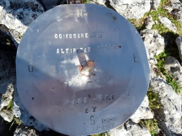
Cimas: Altipitatx (1.155), Ipergorta (1.228m) y Gorosteta (1.255m).
Desnivel acumulado: 1.125m.
Distancia: 17,04km.
Duraciû°n: 6h y 37min.
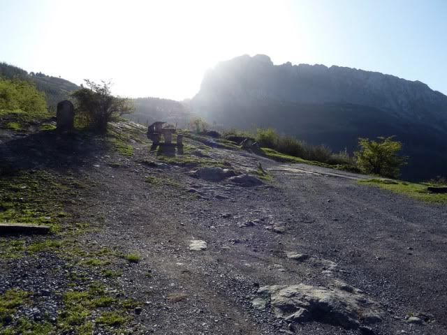
Acceso: Partimos desde el barrio vizcaûÙno de Urigoiti, perteneciente a Orozko. Desde Donostia salimos direcciû°n Bilbao por la autopista A-8. Tomamos la salida de Arrigorriaga y enfilamos hacia Vitoria por la AP-68. Cogemos la salida de Llodio y nos desviamos por la izquierda hacia Orozko. AllûÙ nace la carretera que asciende a Urigoiti.
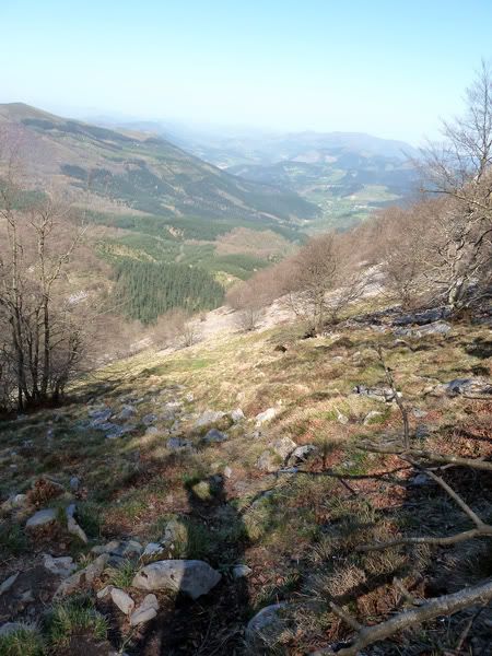
Ver mapa mûÀs grande9:53. En realidad, apuro en coche hasta el parking de Elezkin (494m). Va a ser un dûÙa largo y hace mucho calor, de modo que toda ayuda serûÀ bienvenida...
[url=http://s187.photobucket.com/albums/x273/jefoce/2010%20noviembre/?action=view&current=P1000848_.jpg]
[/url]
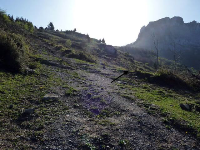
Tras pasar una barrera, me desvûÙo por la derecha.
[url=http://s187.photobucket.com/albums/x273/jefoce/2010%20noviembre/?action=view&current=P1000850_repor.jpg]
[/url]
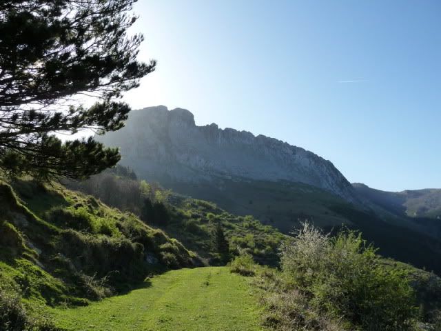
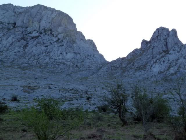
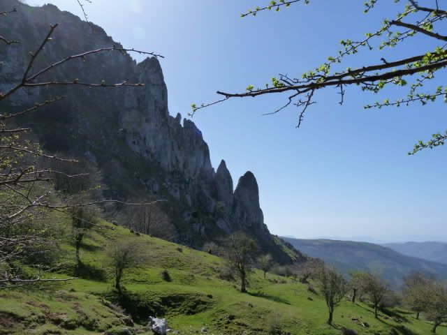
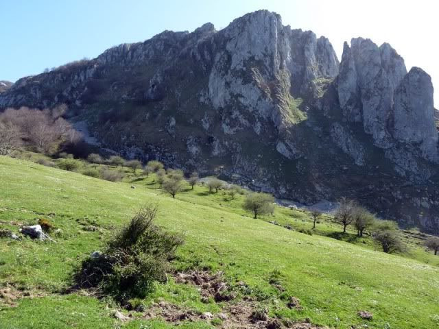
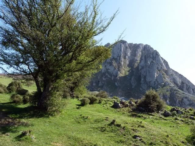
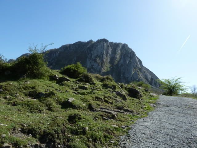
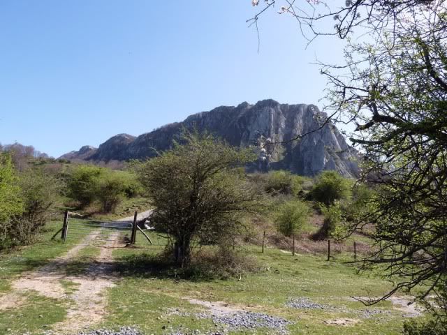
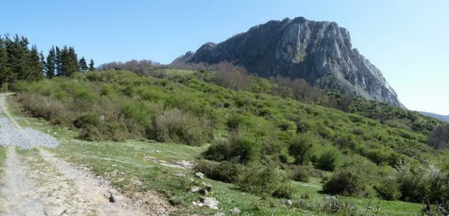
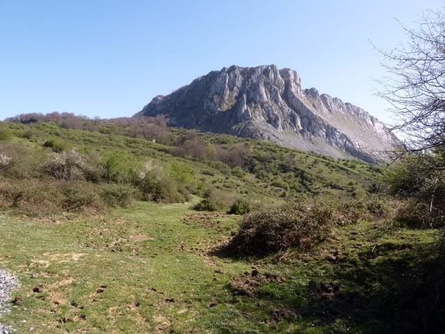
Y enfilo hacia las Atxas. Esa mole.
[url=http://s187.photobucket.com/albums/x273/jefoce/2010%20noviembre/?action=view&current=P1000852_.jpg]
[/url]
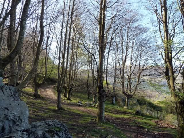
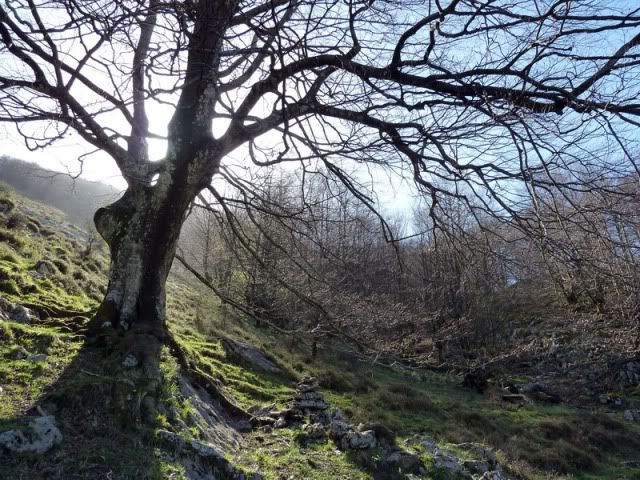
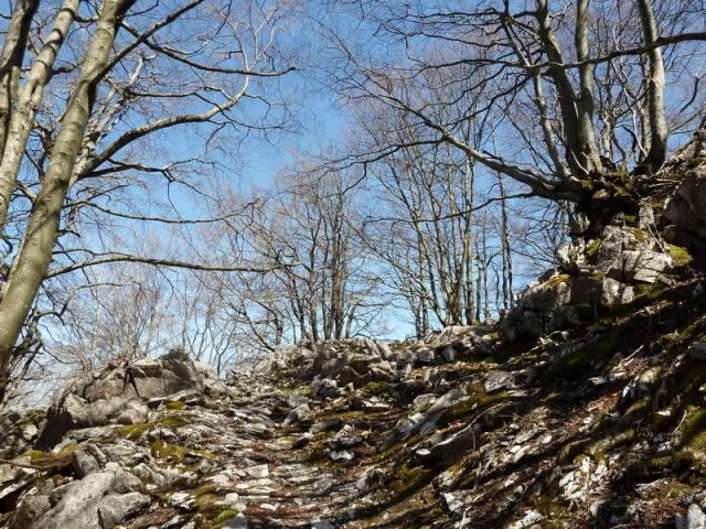
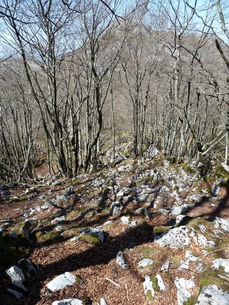
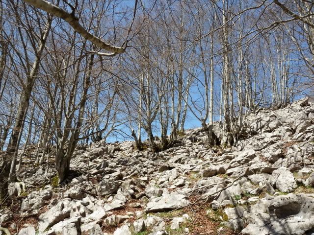
Atravieso un hayedo.
[url=http://s187.photobucket.com/albums/x273/jefoce/2010%20noviembre/?action=view&current=P1000853_.jpg]
[/url]
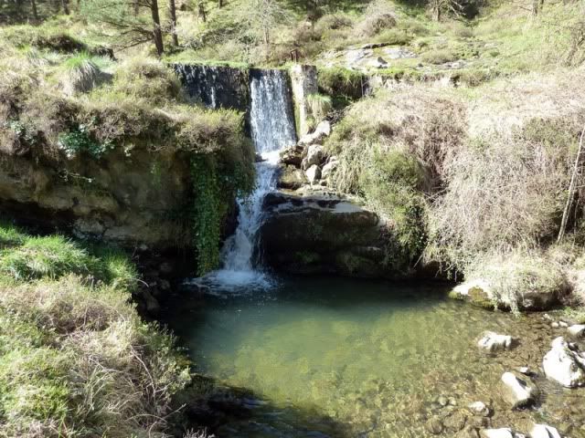
Y me voy acercando a la cascada de Aldabide.
[url=http://s187.photobucket.com/albums/x273/jefoce/2010%20noviembre/?action=view&current=P1000854_.jpg]
[/url]
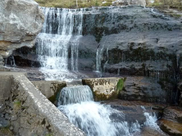
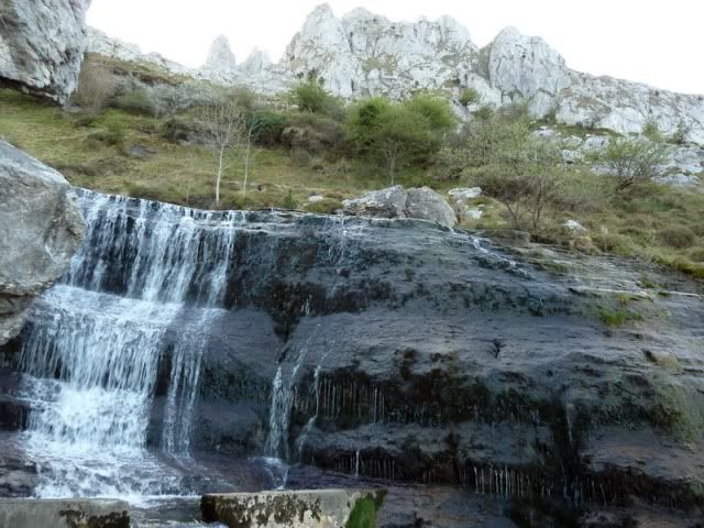
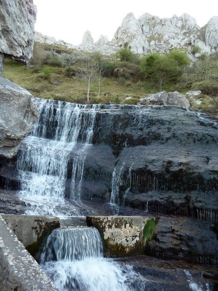
10:23. Cascada de Aldabide (670m). Un paraje de postal.
[url=http://s187.photobucket.com/albums/x273/jefoce/2010%20noviembre/?action=view&current=P1000856_.jpg]
[/url]
[url=http://s187.photobucket.com/albums/x273/jefoce/2010%20noviembre/?action=view&current=P1000857_.jpg]
[/url]
[url=http://s187.photobucket.com/albums/x273/jefoce/2010%20noviembre/?action=view&current=P1000858_.jpg]
[/url]
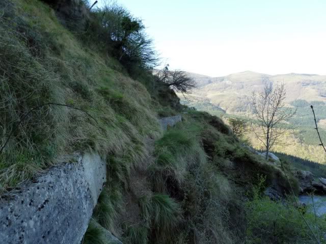
Desde este punto arranca hacia el sur el canal de Sintxita. Una travesûÙa horizontal entre la hierba.
[url=http://s187.photobucket.com/albums/x273/jefoce/2010%20noviembre/?action=view&current=P1000861_.jpg]
[/url]
Urigoiti.
[url=http://s187.photobucket.com/albums/x273/jefoce/2010%20noviembre/?action=view&current=P1000862_.jpg]
[/url]
Y algunas cimas vizcaûÙnas.
[url=http://s187.photobucket.com/albums/x273/jefoce/2010%20noviembre/?action=view&current=P1000863_repor.jpg]
[/url]
Al este tengo un canal que sirve de acceso directo al Axkorrigan. Un buen repecho.
[url=http://s187.photobucket.com/albums/x273/jefoce/2010%20noviembre/?action=view&current=P1000865_.jpg]
[/url]
Sigo por el canal con algunos parajes espectaculares.
[url=http://s187.photobucket.com/albums/x273/jefoce/2010%20noviembre/?action=view&current=P1000866_.jpg]
[/url]
[url=http://s187.photobucket.com/albums/x273/jefoce/2010%20noviembre/?action=view&current=P1000867_.jpg]
[/url]
Brotes de la primavera.
[url=http://s187.photobucket.com/albums/x273/jefoce/2010%20noviembre/?action=view&current=P1000868_.jpg]
[/url]
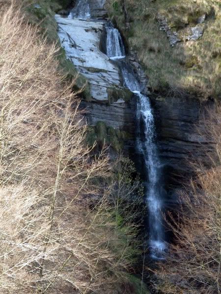
11:01. Presa de Sintxita (686m). El canal termina y se llega a una cascada con una presa.
[url=http://s187.photobucket.com/albums/x273/jefoce/2010%20noviembre/?action=view&current=P1000870_.jpg]
[/url]
[url=http://s187.photobucket.com/albums/x273/jefoce/2010%20noviembre/?action=view&current=P1000871_.jpg]
[/url]
AquûÙ hay que estar atentos a las marcas y enfilar poco a poco hacia el este.
[url=http://s187.photobucket.com/albums/x273/jefoce/2010%20noviembre/?action=view&current=P1000873_.jpg]
[/url]
Ahora viene uno de los puntos mûÀs pesados del dûÙa: un repecho que se me hace eterno.
[url=http://s187.photobucket.com/albums/x273/jefoce/2010%20noviembre/?action=view&current=P1000874_.jpg]
[/url]
[url=http://s187.photobucket.com/albums/x273/jefoce/2010%20noviembre/?action=view&current=P1000875_.jpg]
[/url]
[url=http://s187.photobucket.com/albums/x273/jefoce/2010%20noviembre/?action=view&current=P1000876_.jpg]
[/url]
Por fin alcanzo la planicie superior.
[url=http://s187.photobucket.com/albums/x273/jefoce/2010%20noviembre/?action=view&current=P1000877_.jpg]
[/url]
Momento para girar a la izquierda (este) y apurar los û¤ltimos metros de la primera cima.
[url=http://s187.photobucket.com/albums/x273/jefoce/2010%20noviembre/?action=view&current=P1000879_.jpg]
[/url]
[url=http://s187.photobucket.com/albums/x273/jefoce/2010%20noviembre/?action=view&current=P1000880_.jpg]
[/url]
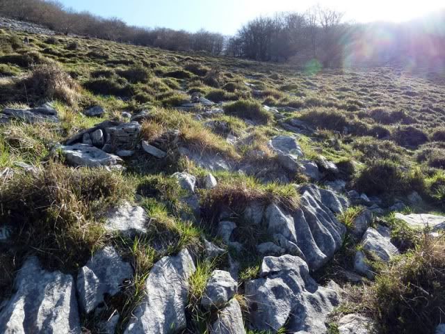
Por un afilado lapiaz.
[url=http://s187.photobucket.com/albums/x273/jefoce/2010%20noviembre/?action=view&current=P1000881_.jpg]
[/url]
[url=http://s187.photobucket.com/albums/x273/jefoce/2010%20noviembre/?action=view&current=P1000882_.jpg]
[/url]
[url=http://s187.photobucket.com/albums/x273/jefoce/2010%20noviembre/?action=view&current=P1000883_.jpg]
[/url]
[url=http://s187.photobucket.com/albums/x273/jefoce/2010%20noviembre/?action=view&current=P1000884_.jpg]
[/url]
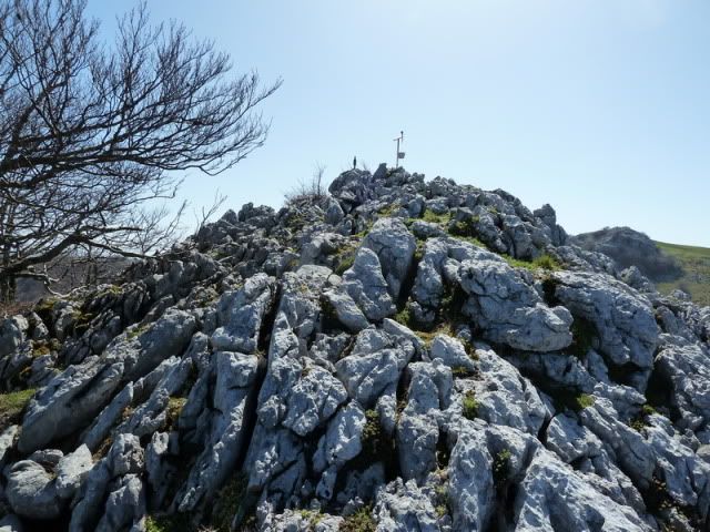
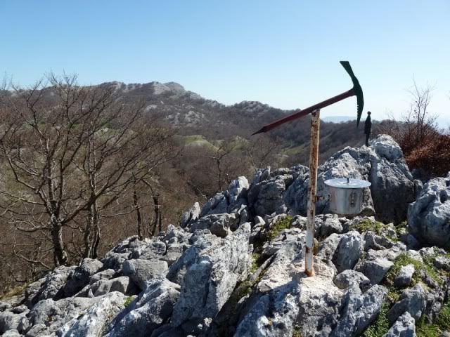
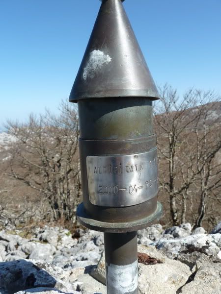
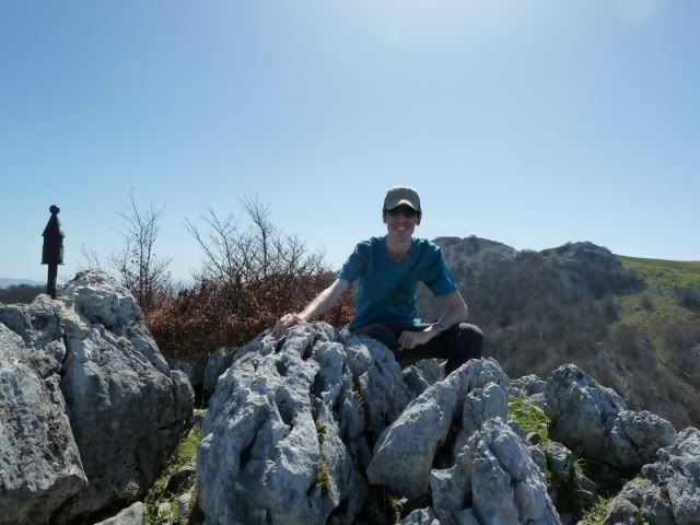
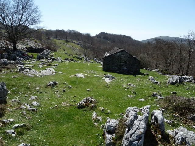
12:09. Altipitatx (1.155m), en dos horas y cuarto desde Elezkin.
[url=http://s187.photobucket.com/albums/x273/jefoce/2010%20noviembre/?action=view&current=P1000885_.jpg]
[/url]
[url=http://s187.photobucket.com/albums/x273/jefoce/2010%20noviembre/?action=view&current=P1000886_.jpg]
[/url]
[url=http://s187.photobucket.com/albums/x273/jefoce/2010%20noviembre/?action=view&current=P1000887_.jpg]
[/url]
[url=http://s187.photobucket.com/albums/x273/jefoce/2010%20noviembre/?action=view&current=P1000893_.jpg]
[/url]
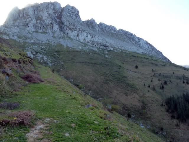
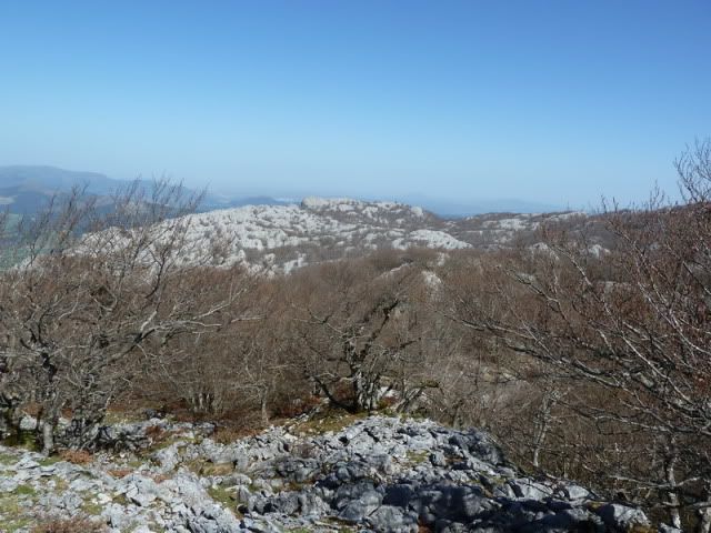
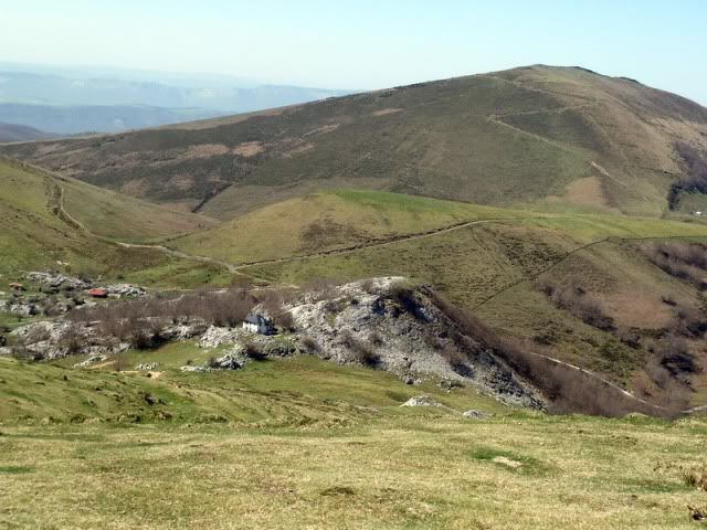
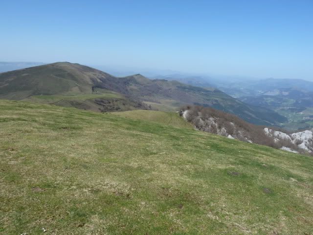
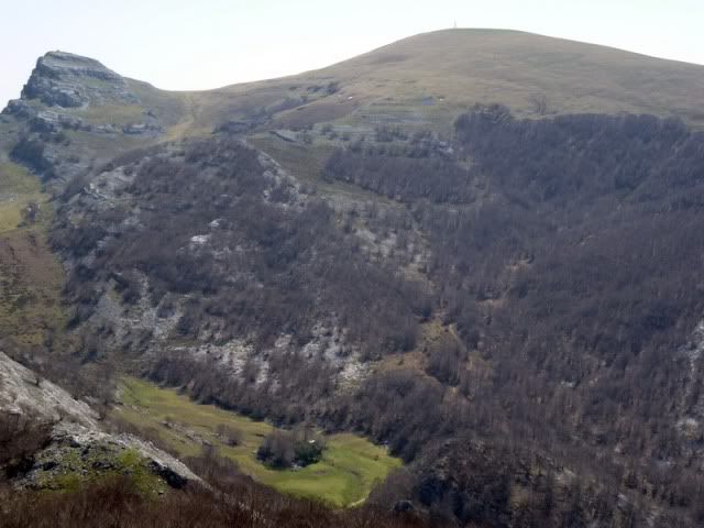
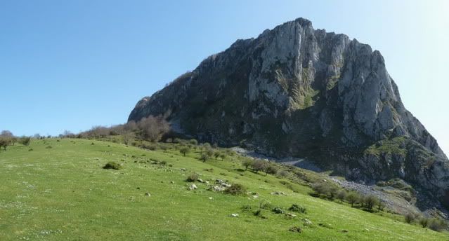
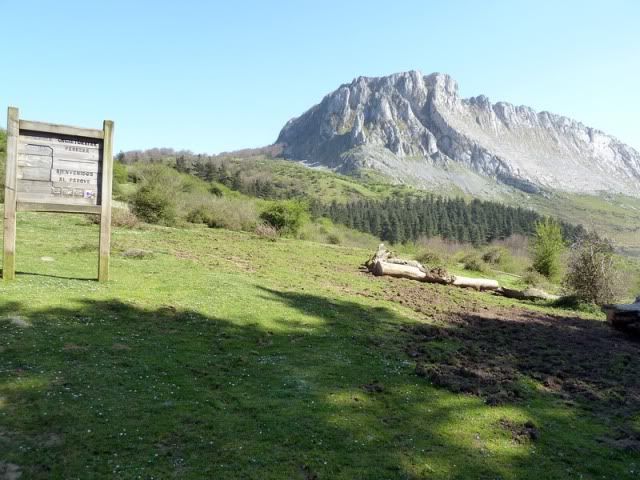
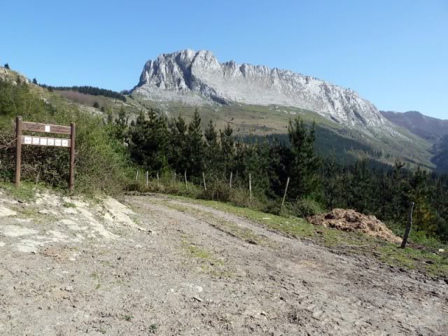
Itxina.
[url=http://s187.photobucket.com/albums/x273/jefoce/2010%20noviembre/?action=view&current=P1000888_.jpg]
[/url]
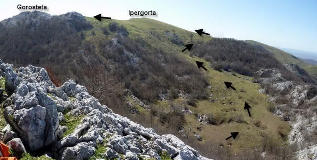
Al sur tengo las dos prû°ximas cimas y el recorrido que efectuarûˋ (flechas negras).
[url=http://s187.photobucket.com/albums/x273/jefoce/2010%20noviembre/?action=view&current=pano1_repor-4.jpg]
[/url]
Hacia el oeste.
[url=http://s187.photobucket.com/albums/x273/jefoce/2010%20noviembre/?action=view&current=pano2_repor.jpg]
[/url]
Tras comer algo, desciendo por el mismo camino.
[url=http://s187.photobucket.com/albums/x273/jefoce/2010%20noviembre/?action=view&current=P1000894_.jpg]
[/url]
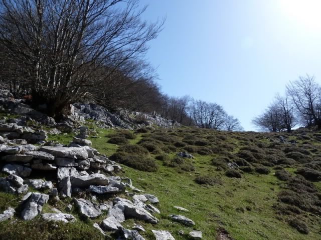
Un breve tramo de lapiaz.
[url=http://s187.photobucket.com/albums/x273/jefoce/2010%20noviembre/?action=view&current=P1000895_.jpg]
[/url]
Y camino por alfombra verde hacia el Ipergorta.
[url=http://s187.photobucket.com/albums/x273/jefoce/2010%20noviembre/?action=view&current=P1000896_.jpg]
[/url]
[url=http://s187.photobucket.com/albums/x273/jefoce/2010%20noviembre/?action=view&current=P1000898_.jpg]
[/url]
La majada de Austiarmin antecede al Oderiaga.
[url=http://s187.photobucket.com/albums/x273/jefoce/2010%20noviembre/?action=view&current=P1000899_.jpg]
[/url]
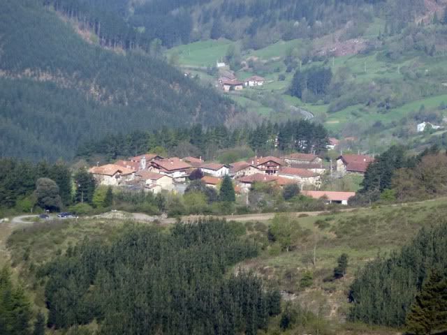
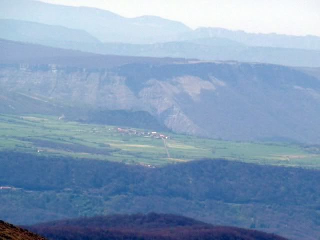
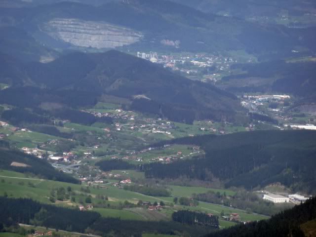
La localidad alavesa de Untzaga, punto de partida para visitar la cascada del Nerviû°n desde arriba.
[url=http://s187.photobucket.com/albums/x273/jefoce/2010%20noviembre/?action=view&current=P1000900_.jpg]
[/url]
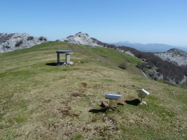
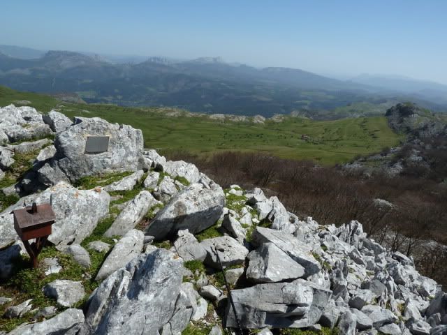
13:03. Ipergorta (1.228m).
[url=http://s187.photobucket.com/albums/x273/jefoce/2010%20noviembre/?action=view&current=P1000901_.jpg]
[/url]
Con su mesa de orientaciû°n.
[url=http://s187.photobucket.com/albums/x273/jefoce/2010%20noviembre/?action=view&current=P1000902_repor.jpg]
[/url]
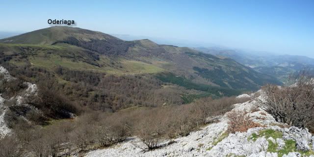
Hacia Oderiaga.
[url=http://s187.photobucket.com/albums/x273/jefoce/2010%20noviembre/?action=view&current=P1000903_.jpg]
[/url]
Hacia Itxina.
[url=http://s187.photobucket.com/albums/x273/jefoce/2010%20noviembre/?action=view&current=P1000904_.jpg]
[/url]
Y hacia Gorosteta, mi prû°ximo destino.
[url=http://s187.photobucket.com/albums/x273/jefoce/2010%20noviembre/?action=view&current=P1000905_.jpg]
[/url]
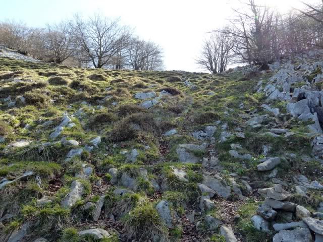
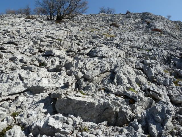
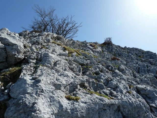
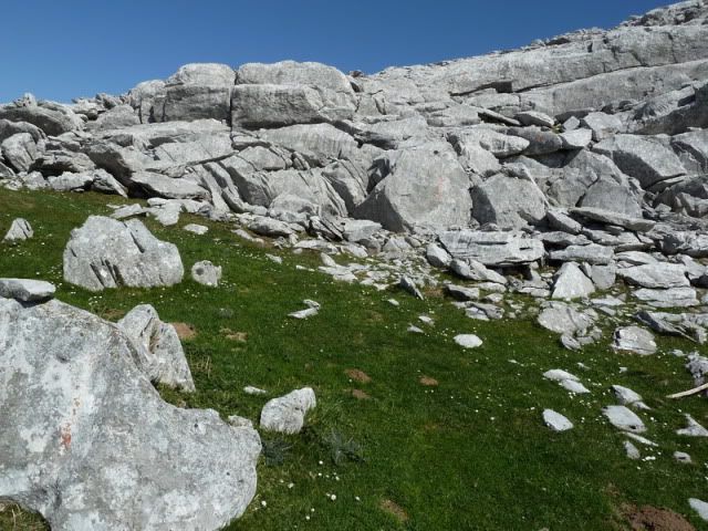
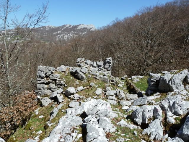
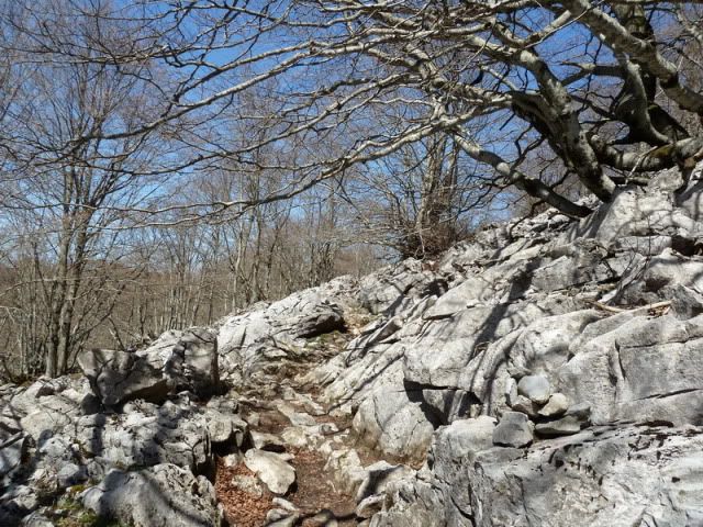
La parte final exige algo de atenciû°n por el lapiaz.
[url=http://s187.photobucket.com/albums/x273/jefoce/2010%20noviembre/?action=view&current=P1000907_.jpg]
[/url]
[url=http://s187.photobucket.com/albums/x273/jefoce/2010%20noviembre/?action=view&current=P1000908_.jpg]
[/url]
[url=http://s187.photobucket.com/albums/x273/jefoce/2010%20noviembre/?action=view&current=P1000909_.jpg]
[/url]
13:18. Gorosteta (1.255m).
[url=http://s187.photobucket.com/albums/x273/jefoce/2010%20noviembre/?action=view&current=P1000910_.jpg]
[/url]
[url=http://s187.photobucket.com/albums/x273/jefoce/2010%20noviembre/?action=view&current=P1000918_.jpg]
[/url]
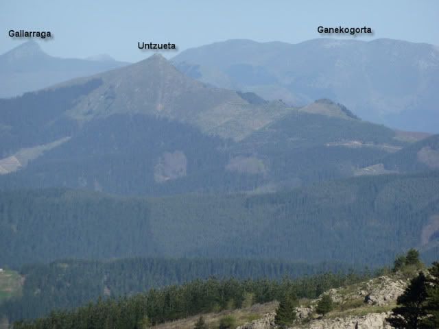
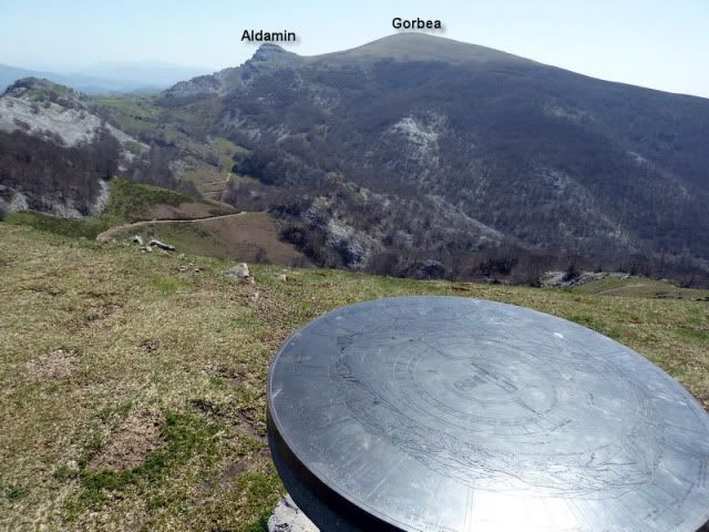
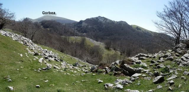
Aldamin y Gorbea.
[url=http://s187.photobucket.com/albums/x273/jefoce/2010%20noviembre/?action=view&current=P1000911_.jpg]
[/url]
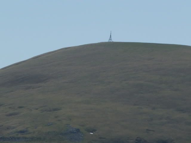
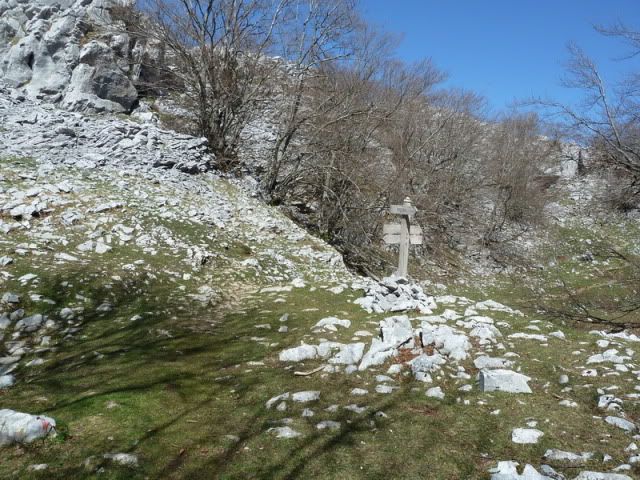
La cruz del Gorbea.
[url=http://s187.photobucket.com/albums/x273/jefoce/2010%20noviembre/?action=view&current=P1000912_.jpg]
[/url]
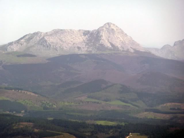
Anboto.
[url=http://s187.photobucket.com/albums/x273/jefoce/2010%20noviembre/?action=view&current=P1000913_.jpg]
[/url]
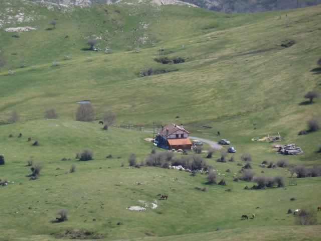
El refugio de Arraba.
[url=http://s187.photobucket.com/albums/x273/jefoce/2010%20noviembre/?action=view&current=P1000914_.jpg]
[/url]
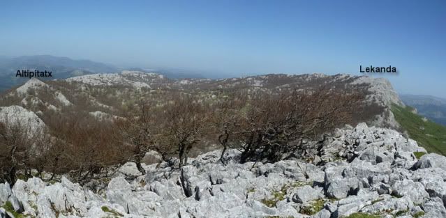
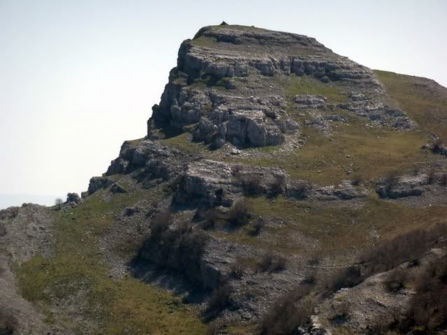
Hacia el Lekanda.
[url=http://s187.photobucket.com/albums/x273/jefoce/2010%20noviembre/?action=view&current=pano3_repor.jpg]
[/url]
Aldamin.
[url=http://s187.photobucket.com/albums/x273/jefoce/2010%20noviembre/?action=view&current=P1000917_.jpg]
[/url]
Desciendo al collado entre el Gorosteta y el Ipergorta.
[url=http://s187.photobucket.com/albums/x273/jefoce/2010%20noviembre/?action=view&current=P1000919_.jpg]
[/url]
Una llamada telefû°nica me despista y pierdo un desnivel que luego habrûˋ de ganar otra vez. Tiro de GPS para recuperar la senda balizada hacia Kargaleku.
[url=http://s187.photobucket.com/albums/x273/jefoce/2010%20noviembre/?action=view&current=P1000920_.jpg]
[/url]
Y entro en Itxina.
[url=http://s187.photobucket.com/albums/x273/jefoce/2010%20noviembre/?action=view&current=P1000921_.jpg]
[/url]
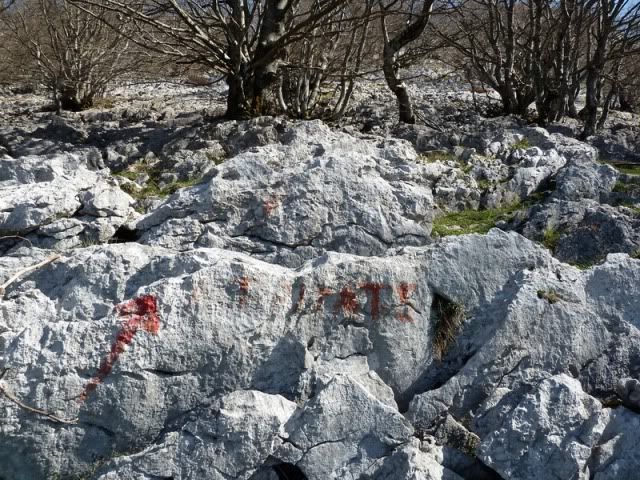
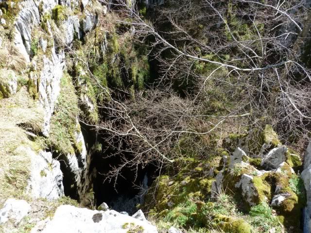
14:05. Neberazarra (1.136m). Un lugar que me acongoja. Una grieta impresionante en la que se almacena la nieve hasta bien entrada la primavera.
[url=http://s187.photobucket.com/albums/x273/jefoce/2010%20noviembre/?action=view&current=P1000922_.jpg]
[/url]
[url=http://s187.photobucket.com/albums/x273/jefoce/2010%20noviembre/?action=view&current=P1000923_.jpg]
[/url]
[url=http://s187.photobucket.com/albums/x273/jefoce/2010%20noviembre/?action=view&current=P1000924_.jpg]
[/url]
Este tema de las grietas siempre me deja mal cuerpo. Mal rollo. Una sensaciû°n extraûÝa. AsûÙ que me largo rûÀpidamente.
[url=http://s187.photobucket.com/albums/x273/jefoce/2010%20noviembre/?action=view&current=P1000925_.jpg]
[/url]
Y sigo por el sendero. El calor va haciendo mella.
[url=http://s187.photobucket.com/albums/x273/jefoce/2010%20noviembre/?action=view&current=P1000926_.jpg]
[/url]
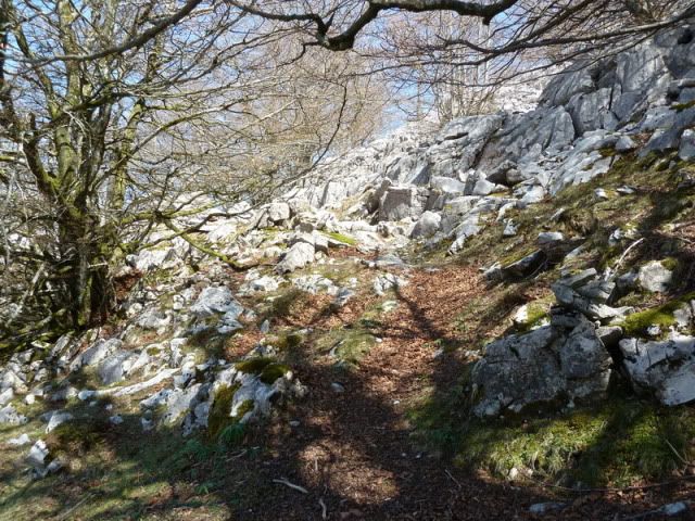
Llego a Kargaleku y tiro hacia Lexardi (norte).
[url=http://s187.photobucket.com/albums/x273/jefoce/2010%20noviembre/?action=view&current=P1000927_.jpg]
[/url]
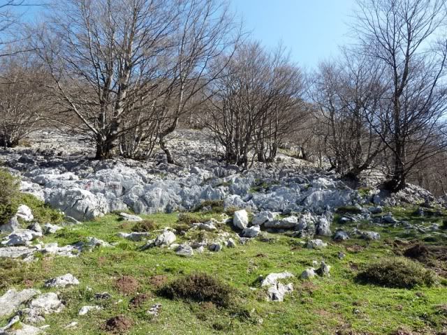
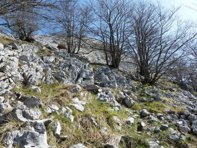
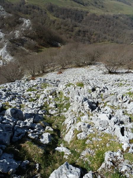
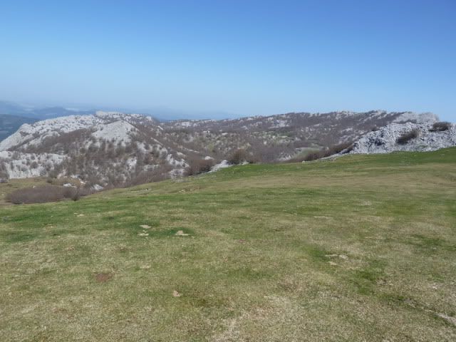
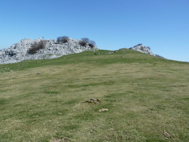
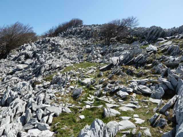
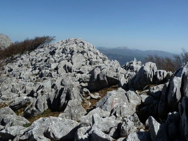
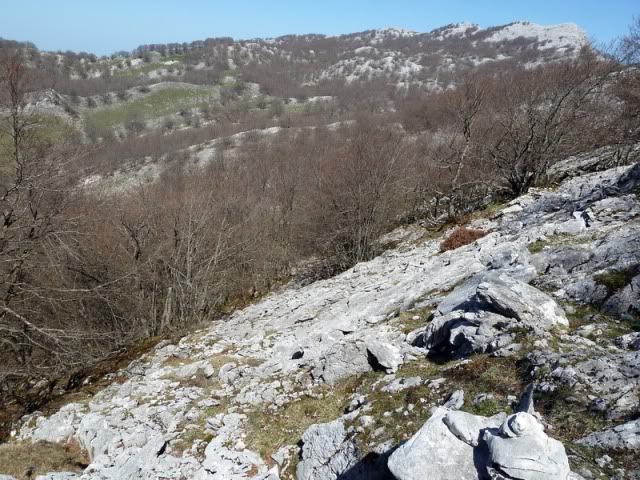
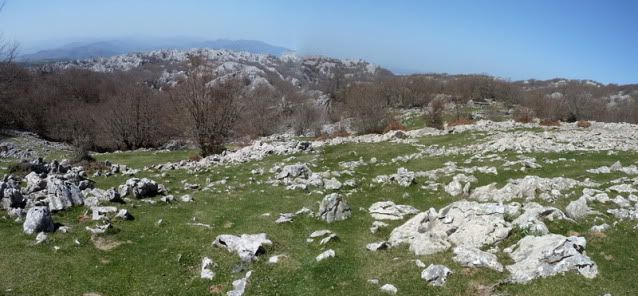
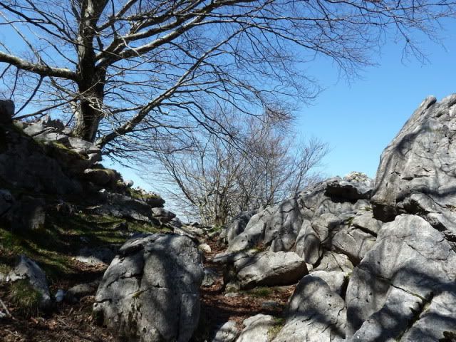
Por unos parajes de quitar el hipo. Puro karst. Puro Itxina.
[url=http://s187.photobucket.com/albums/x273/jefoce/2010%20noviembre/?action=view&current=P1000928_.jpg]
[/url]
[url=http://s187.photobucket.com/albums/x273/jefoce/2010%20noviembre/?action=view&current=P1000929_.jpg]
[/url]
Mirada atrûÀs.
[url=http://s187.photobucket.com/albums/x273/jefoce/2010%20noviembre/?action=view&current=pano4_repor.jpg]
[/url]
Mirada delante.
[url=http://s187.photobucket.com/albums/x273/jefoce/2010%20noviembre/?action=view&current=pano5_.jpg]
[/url]
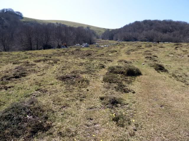
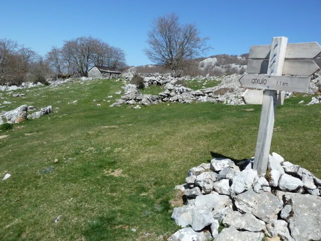
14:50. Majada de Lexardi (1.101m).
[url=http://s187.photobucket.com/albums/x273/jefoce/2010%20noviembre/?action=view&current=P1000934_.jpg]
[/url]
[url=http://s187.photobucket.com/albums/x273/jefoce/2010%20noviembre/?action=view&current=P1000935_.jpg]
[/url]
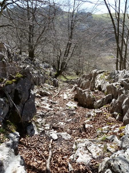
La senda sigue traviesa. Sorteando como puede la orografûÙa.
[url=http://s187.photobucket.com/albums/x273/jefoce/2010%20noviembre/?action=view&current=P1000936_.jpg]
[/url]
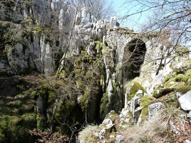
Hasta que salgo al entorno de Atxulaur. Le confieso una cosa. TenûÙa un as en la manga, que consistûÙa en realizar desde este punto una pequeûÝa circular para conocer la cueva de Supelegor y las cimas de Axkorrigan, Urtutxe y Atxulaurgo aitza. Pero no pude. Vi la escapatoria cerca. Y me rendûÙ. HacûÙa tanto calor...
[url=http://s187.photobucket.com/albums/x273/jefoce/2010%20noviembre/?action=view&current=P1000937_.jpg]
[/url]
[url=http://s187.photobucket.com/albums/x273/jefoce/2010%20noviembre/?action=view&current=P1000938_.jpg]
[/url]
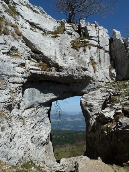
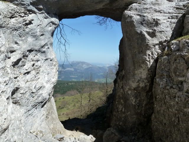
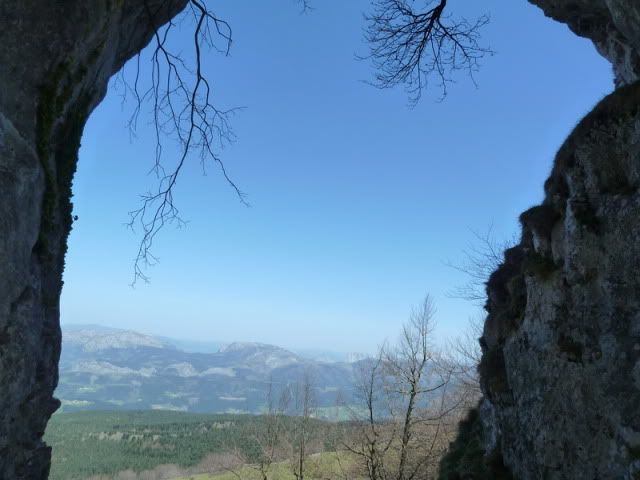
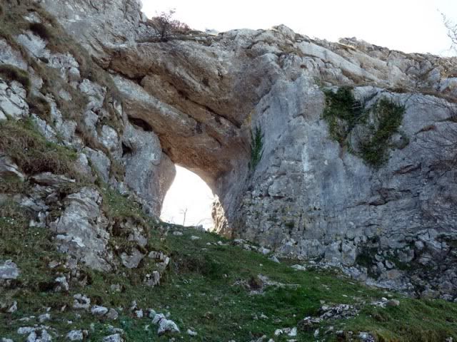
15:17. Ojo de Atxulaur (1.093m). Otro punto mûÀgico. Muy especial.
[url=http://s187.photobucket.com/albums/x273/jefoce/2010%20noviembre/?action=view&current=P1000939_.jpg]
[/url]
[url=http://s187.photobucket.com/albums/x273/jefoce/2010%20noviembre/?action=view&current=P1000940_.jpg]
[/url]
[url=http://s187.photobucket.com/albums/x273/jefoce/2010%20noviembre/?action=view&current=P1000941_.jpg]
[/url]
[url=http://s187.photobucket.com/albums/x273/jefoce/2010%20noviembre/?action=view&current=P1000942_.jpg]
[/url]
[url=http://s187.photobucket.com/albums/x273/jefoce/2010%20noviembre/?action=view&current=P1000943_.jpg]
[/url]
Hacia Lemoa.
[url=http://s187.photobucket.com/albums/x273/jefoce/2010%20noviembre/?action=view&current=P1000944_.jpg]
[/url]
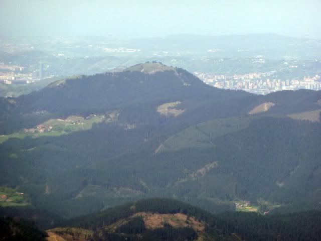
Y tambiûˋn se divisaba el Gran Bilbao.
[url=http://s187.photobucket.com/albums/x273/jefoce/2010%20noviembre/?action=view&current=P1000945_.jpg]
[/url]
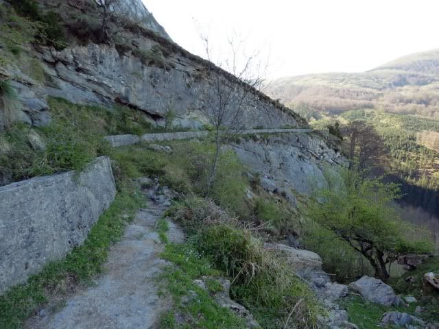
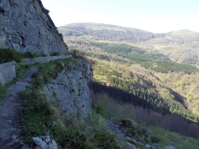
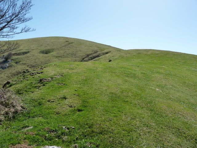
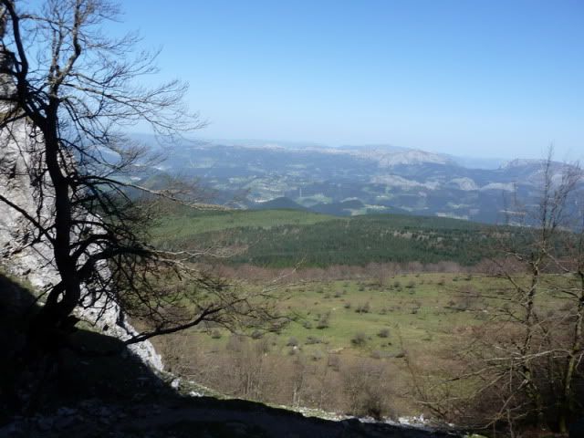
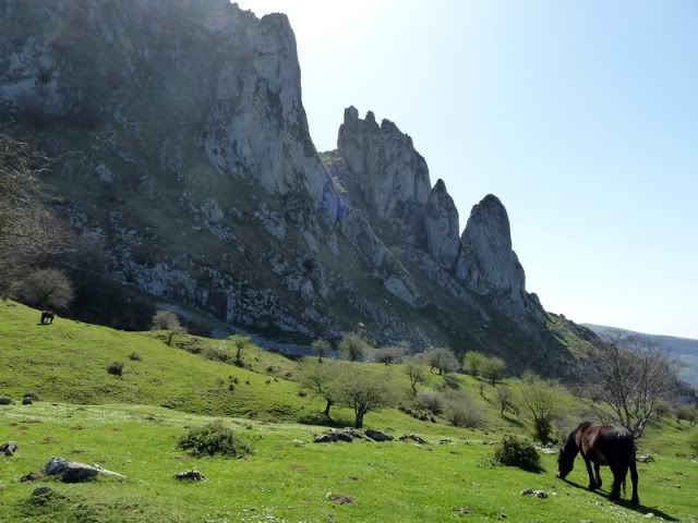
Salgo a las campas del otro lado y giro al norte. Voy pegado a las Atxas. El û¤ltimo espectûÀculo del dûÙa. Casi le dirûÙa que volvûÙ al coche como los cangrejos. Hacia atrûÀs.
[url=http://s187.photobucket.com/albums/x273/jefoce/2010%20noviembre/?action=view&current=P1000947_.jpg]
[/url]
[url=http://s187.photobucket.com/albums/x273/jefoce/2010%20noviembre/?action=view&current=P1000948_.jpg]
[/url]
[url=http://s187.photobucket.com/albums/x273/jefoce/2010%20noviembre/?action=view&current=P1000949_.jpg]
[/url]
[url=http://s187.photobucket.com/albums/x273/jefoce/2010%20noviembre/?action=view&current=P1000950_.jpg]
[/url]
[url=http://s187.photobucket.com/albums/x273/jefoce/2010%20noviembre/?action=view&current=pano6_.jpg]
[/url]
[url=http://s187.photobucket.com/albums/x273/jefoce/2010%20noviembre/?action=view&current=P1000953_.jpg]
[/url]
[url=http://s187.photobucket.com/albums/x273/jefoce/2010%20noviembre/?action=view&current=P1000954_.jpg]
[/url]
[url=http://s187.photobucket.com/albums/x273/jefoce/2010%20noviembre/?action=view&current=P1000955_.jpg]
[/url]
[url=http://s187.photobucket.com/albums/x273/jefoce/2010%20noviembre/?action=view&current=pano7_.jpg]
[/url]
[url=http://s187.photobucket.com/albums/x273/jefoce/2010%20noviembre/?action=view&current=P1000958_.jpg]
[/url]
[url=http://s187.photobucket.com/albums/x273/jefoce/2010%20noviembre/?action=view&current=P1000959_.jpg]
[/url]
Perdû°neme tanta desfachatez. Ya sûˋ que la abundancia estûÀ reûÝida con la delicadeza.
[url=http://s187.photobucket.com/albums/x273/jefoce/2010%20noviembre/?action=view&current=P1000960_.jpg]
[/url]
Fin de la circular.
[url=http://s187.photobucket.com/albums/x273/jefoce/2010%20noviembre/?action=view&current=P1000961_.jpg]
[/url]
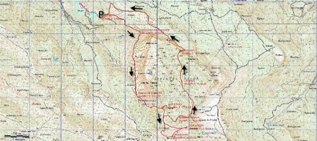
Y os dejo el mapa.
[url=http://s187.photobucket.com/albums/x273/jefoce/2010%20noviembre/?action=view&current=Itxina.jpg]
[/url]
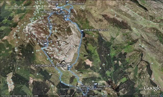
Y os dejo el mapa 3D.
[url=http://s187.photobucket.com/albums/x273/jefoce/2010%20noviembre/?action=view&current=Itxina3D.jpg]
[/url]
Y en wikiloc os dejo el track:
ver trackLAS NOTAS (La escala es del 1 al 5):
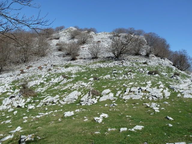
DIFICULTAD: 4. Se trata de un itinerario complejo, que se acaba haciendo pesado debido al lento avance por Itxina. Lleve mucha agua y estûˋ atento en los accesos finales al Altipitatx y Gorosteta. Atravesar Itxina requiere de un ingrediente: paciencia.
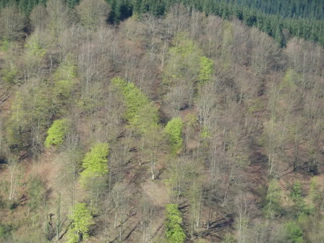
BELLEZA DEL ITINERARIO: 4. Es un recorrido con muchos atractivos. Y muy variado: cascadas, bosques, cimas, extensas panorûÀmicas... Itxina le encantarûÀ o jurarûÀ no volver en la vida. Una de dos.
IMPORTANCIA DE LA CUMBRE: 3.
Quûˋ tiene Txina que nos deja alelados. Abducidos.


 )
)