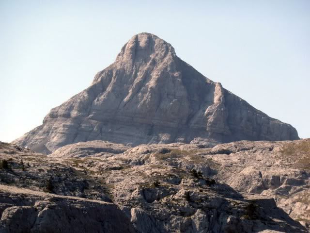
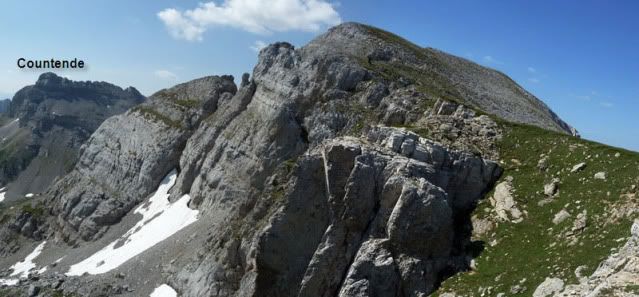
EstarûÀ usted acostumbrado a conocer la cara invernal de esta montaûÝa. Nieve, esquûÙs, remontes y telesillas. Estoy de acuerdo. Pero sepa que existe una versiû°n diferente, mûÀs propia del estûÙo, que tambiûˋn tiene su encanto. El martes realicûˋ una circular en torno al Soumcouy, uno de los colegas del Anie. La subida fue sosa, monû°tona, por las pistas, pero el descenso estuvo lleno de grandeza por la vertiente de Lescun. He aquûÙ el Soumcouy con el traje veraniego.
Ubicaciû°n: Macizo de Larra, Pirineos, Francia.
Cima: Soumcouy (2.302m).
Desnivel acumulado: 1.079m.
Distancia: 16,74km.
Duraciû°n: 6h y 25min.
Acceso: Partimos desde la estaciû°n de esquûÙ de la Piedra de San MartûÙn, en Francia. Desde Donostia salimos direcciû°n Pamplona por la autovûÙa A-15. Cogemos la carretera de Jaca y tomamos la salida de Irunberri/Lumbier. En Navascuûˋs subimos el puerto de Coronas para bajar a Burgi. De aquûÙ seguimos al norte para pasar Roncal, Urzainki y llegar a Isaba. Seguimos subiendo y ascendemos por Belagua hasta el collado de Ernaz. Al poco de descender se halla la estaciû°n de esquûÙ. url=http://maps.google.es/maps?f=q&source=embed&hl=es&geocode=&q=arette,+la+pierre+saint+martin&aq=&g=Collado+de+la+Piedra+de+San+Mart%C3%ADn,+31417+Isaba&ie=UTF8&hq=&hnear=Arette+la+Pierre+Saint-Martin,+Arette,+Pyr%C3%A9n%C3%A9es-Atlantiques,+Aquitania,+Francia&ll=42.977603,-0.744861&spn=0.113785,0.3368&z=12]Ver mapa mûÀs grande[/url]
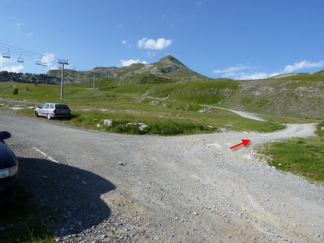
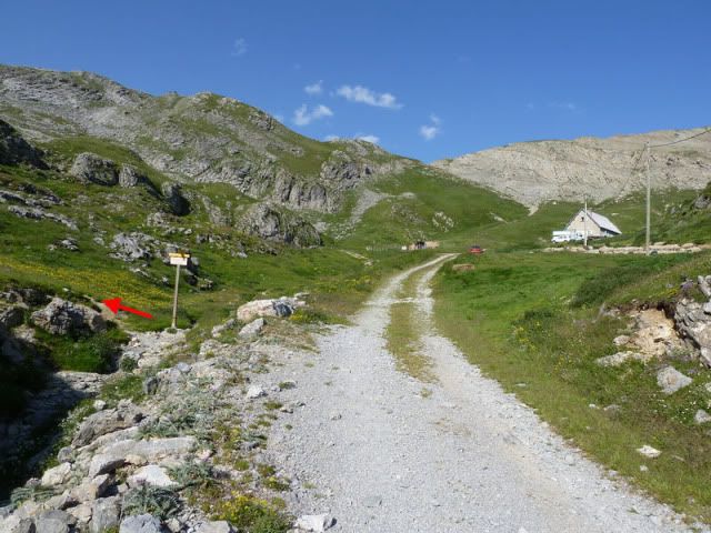
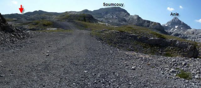
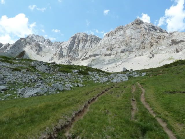
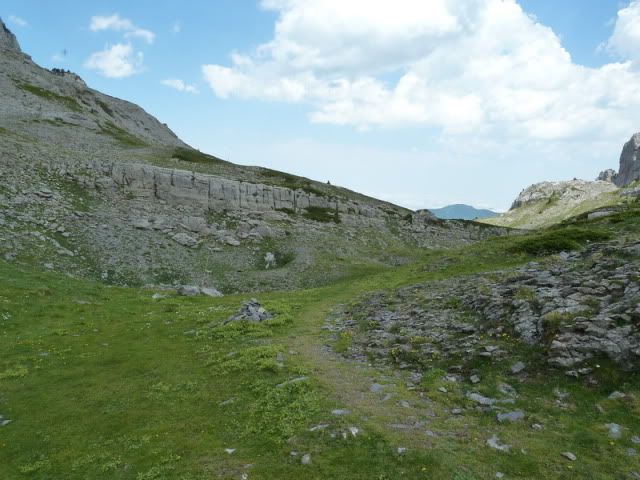
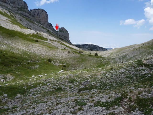
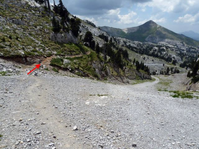
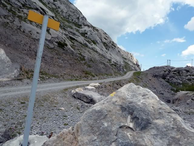
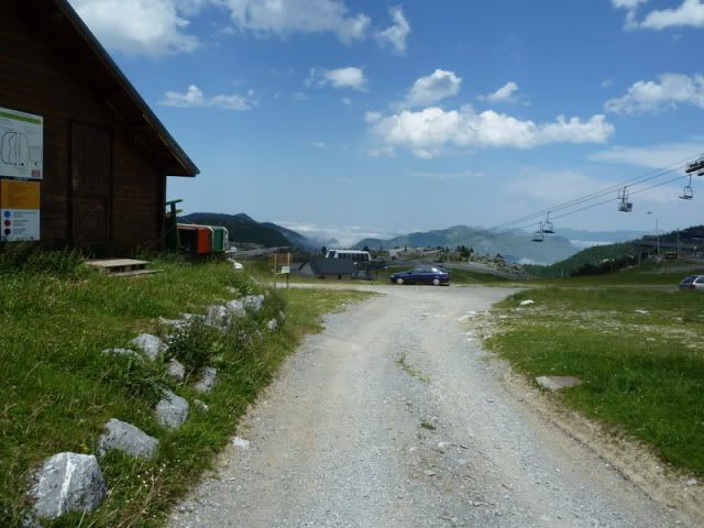
9:22. Aparco al lado del refugio Haendel (1.645m) y tomo esta pista (flecha roja).
[url=http://s187.photobucket.com/albums/x273/jefoce/2010%20noviembre/?action=view&current=p1010523_resizerepor.jpg]
[/url]
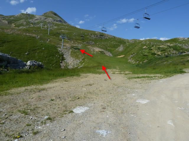
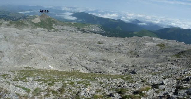
Enseguida la acorto por este atajo, siempre con el Arlas en el horizonte.
[url=http://s187.photobucket.com/albums/x273/jefoce/2010%20noviembre/?action=view&current=p1010524_resizerepor.jpg]
[/url]
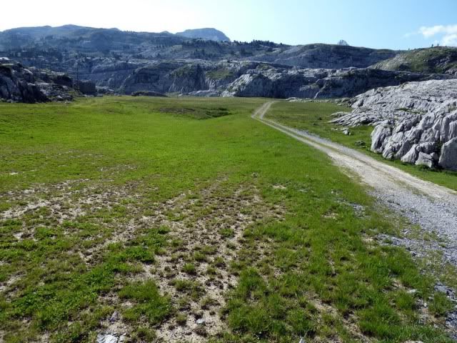
Apuro la pista.
[url=http://s187.photobucket.com/albums/x273/jefoce/2010%20noviembre/?action=view&current=P1010526_resize.jpg]
[/url]
[url=http://s187.photobucket.com/albums/x273/jefoce/2010%20noviembre/?action=view&current=P1010527_resize.jpg]
[/url]
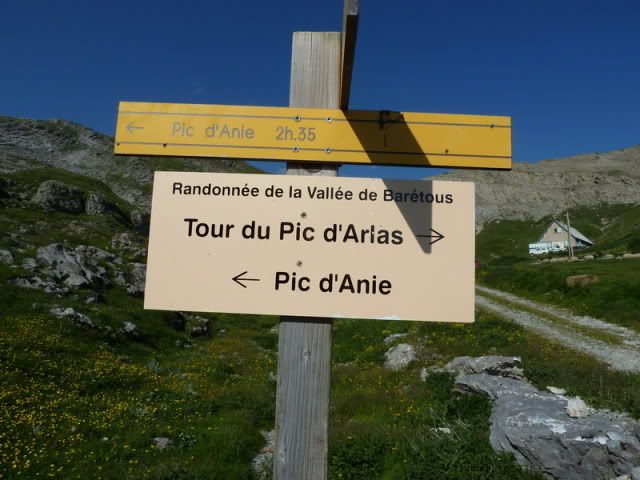
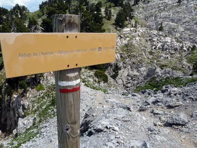
Y en este punto, antes de alcanzar una borda, tomo el desvûÙo balizado al Anie.
[url=http://s187.photobucket.com/albums/x273/jefoce/2010%20noviembre/?action=view&current=p1010528_resizerepor.jpg]
[/url]
[url=http://s187.photobucket.com/albums/x273/jefoce/2010%20noviembre/?action=view&current=P1010529_resize.jpg]
[/url]
Detalle del Arlas.
[url=http://s187.photobucket.com/albums/x273/jefoce/2010%20noviembre/?action=view&current=P1010532_resize.jpg]
[/url]
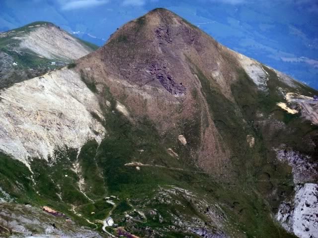
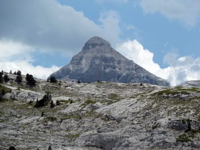
Y el Anie.
[url=http://s187.photobucket.com/albums/x273/jefoce/2010%20noviembre/?action=view&current=P1010533_resize.jpg]
[/url]
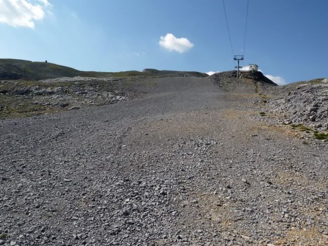
Voy ganando altura por las pistas de la estaciû°n de esquûÙ. No es un tramo montaûÝero que digamos, pero se hace cû°modo.
[url=http://s187.photobucket.com/albums/x273/jefoce/2010%20noviembre/?action=view&current=pano1_resizerepor.jpg]
[/url]
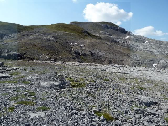
10:33. Alcanzo un collado (2.092m).
[url=http://s187.photobucket.com/albums/x273/jefoce/2010%20noviembre/?action=view&current=P1010537_resize.jpg]

[/url]
Y giro a la derecha.
[url=http://s187.photobucket.com/albums/x273/jefoce/2010%20noviembre/?action=view&current=P1010538_resize.jpg]
[/url]
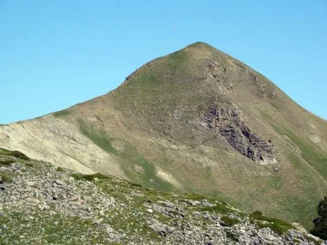
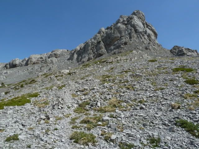
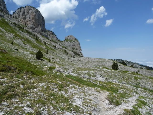
Ya veo el Soumcouy.
[url=http://s187.photobucket.com/albums/x273/jefoce/2010%20noviembre/?action=view&current=P1010539_resize.jpg]
[/url]
Y el sendero es evidente.
[url=http://s187.photobucket.com/albums/x273/jefoce/2010%20noviembre/?action=view&current=P1010540_resize.jpg]
[/url]
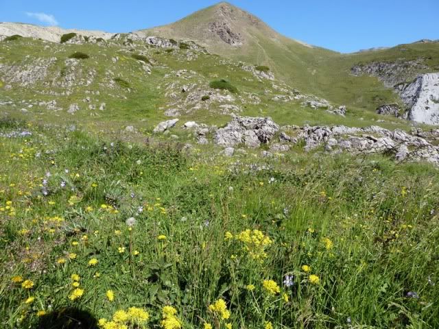
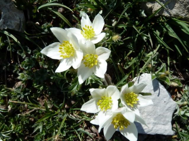
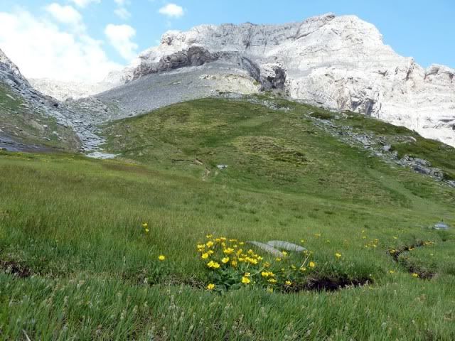
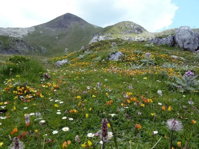
Motivos florales.
[url=http://s187.photobucket.com/albums/x273/jefoce/2010%20noviembre/?action=view&current=P1010542_resize.jpg]
[/url]
[url=http://s187.photobucket.com/albums/x273/jefoce/2010%20noviembre/?action=view&current=P1010544_resize.jpg]
[/url]
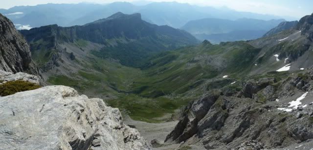
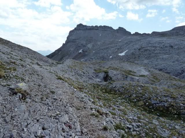
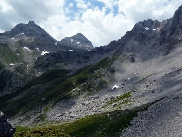
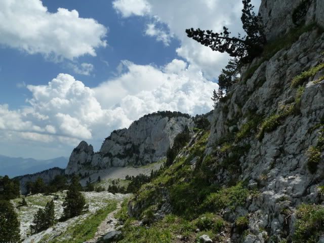
Diviso la vertiente de Lescun, por donde pasarûˋ en unas horas.
[url=http://s187.photobucket.com/albums/x273/jefoce/2010%20noviembre/?action=view&current=pano2_resize.jpg]
[/url]
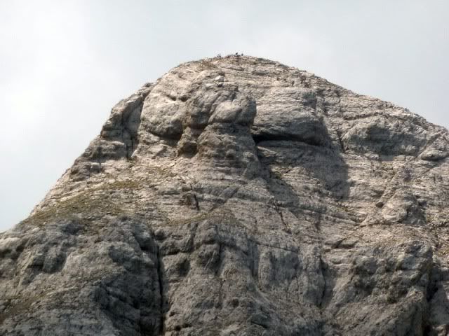
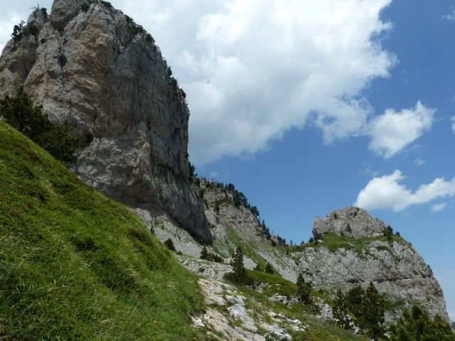
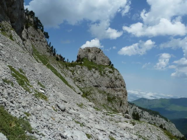
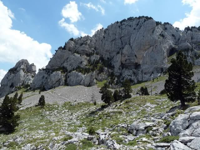
Y voy llegando a la cima. Los û¤ltimos metros son espectaculares. Llenos de grandeza.
[url=http://s187.photobucket.com/albums/x273/jefoce/2010%20noviembre/?action=view&current=pano3_resizerepor.jpg]
[/url]
[url=http://s187.photobucket.com/albums/x273/jefoce/2010%20noviembre/?action=view&current=P1010550_resize.jpg]
[/url]
[url=http://s187.photobucket.com/albums/x273/jefoce/2010%20noviembre/?action=view&current=pano4_resize.jpg]
[/url]
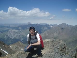
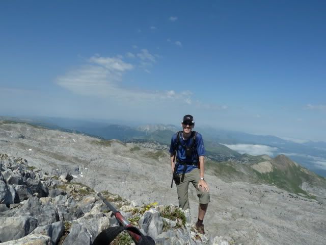
11:03. Soumcouy (2.302m), en una hora y cuarenta minutos desde el coche. Muy poco tiempo de ascensiû°n para tratarse de un dosmil importante de la zona.
[url=http://s187.photobucket.com/albums/x273/jefoce/2010%20noviembre/?action=view&current=P1010553_resize.jpg]
[/url]
[url=http://s187.photobucket.com/albums/x273/jefoce/2010%20noviembre/?action=view&current=P1010554_resize.jpg]
[/url]
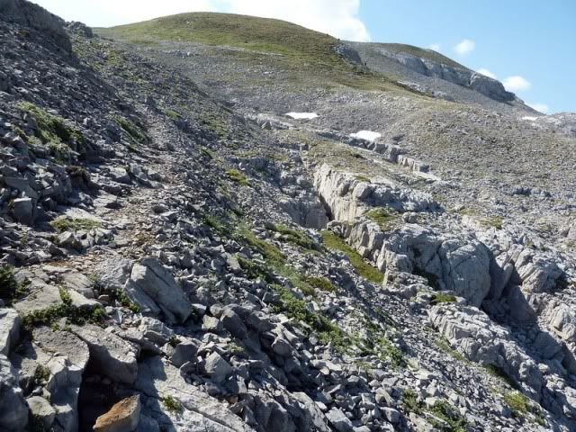
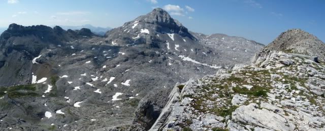
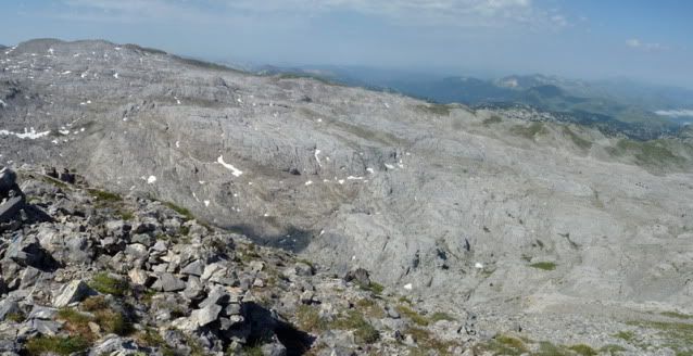
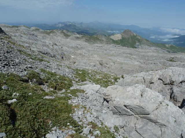
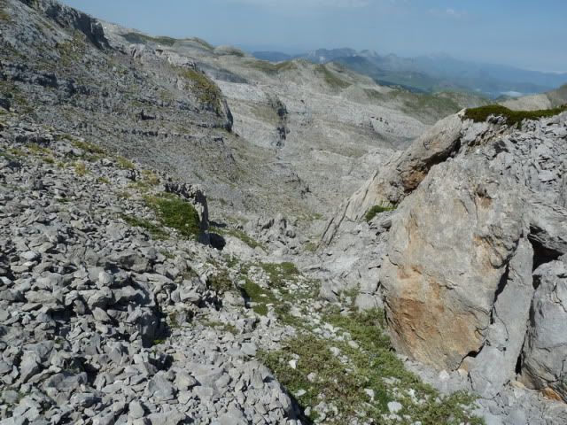
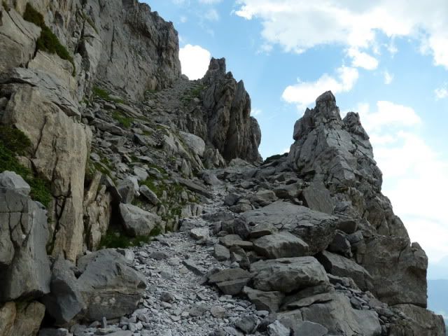
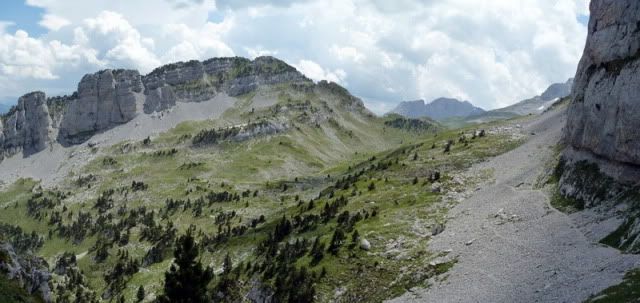
Una zona kûÀrstica a mûÀs no poder.
[url=http://s187.photobucket.com/albums/x273/jefoce/2010%20noviembre/?action=view&current=pano5_resize.jpg]
[/url]
[url=http://s187.photobucket.com/albums/x273/jefoce/2010%20noviembre/?action=view&current=pano6_resizerepor.jpg]
[/url]
Arlas.
[url=http://s187.photobucket.com/albums/x273/jefoce/2010%20noviembre/?action=view&current=P1010559_resize.jpg]
[/url]
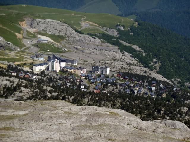
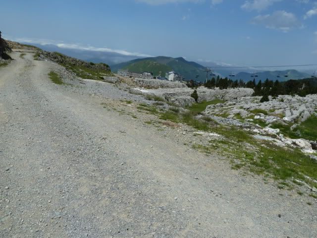
La estaciû°n de esquûÙ.
[url=http://s187.photobucket.com/albums/x273/jefoce/2010%20noviembre/?action=view&current=P1010560_resize.jpg]
[/url]
[url=http://s187.photobucket.com/albums/x273/jefoce/2010%20noviembre/?action=view&current=p1010562_resizerepor.jpg]
[/url]
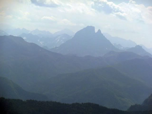
Ossau.
[url=http://s187.photobucket.com/albums/x273/jefoce/2010%20noviembre/?action=view&current=P1010563_resize.jpg]
[/url]
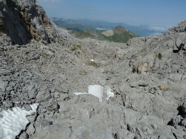
Abandono la cima cuando cumplo las dos horas de marcha. El retorno serûÀ diferente, mucho mûÀs montaûÝero, y tambiûˋn mûÀs complejo. Primero desciendo unos metros por la vûÙa normal hasta coger un valle a la izquierda (oeste).
[url=http://s187.photobucket.com/albums/x273/jefoce/2010%20noviembre/?action=view&current=p1010565_resizerepor.jpg]
[/url]
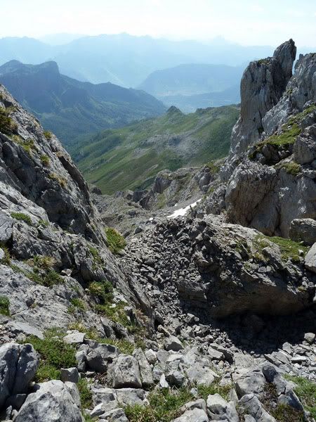
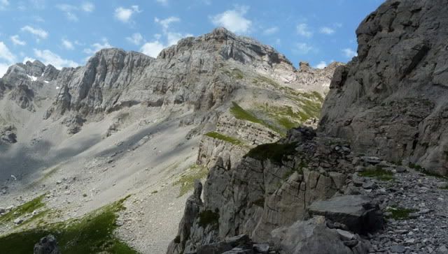
Tirando de GPS, indispensable en un terreno de este tipo, saldrûˋ a la vûÙa normal del Anie.
[url=http://s187.photobucket.com/albums/x273/jefoce/2010%20noviembre/?action=view&current=P1010567_resize.jpg]
[/url]
[url=http://s187.photobucket.com/albums/x273/jefoce/2010%20noviembre/?action=view&current=P1010568_resize.jpg]
[/url]
[url=http://s187.photobucket.com/albums/x273/jefoce/2010%20noviembre/?action=view&current=P1010569_resize.jpg]
[/url]
[url=http://s187.photobucket.com/albums/x273/jefoce/2010%20noviembre/?action=view&current=P1010570_resize.jpg]
[/url]
[url=http://s187.photobucket.com/albums/x273/jefoce/2010%20noviembre/?action=view&current=P1010571_resize.jpg]
[/url]
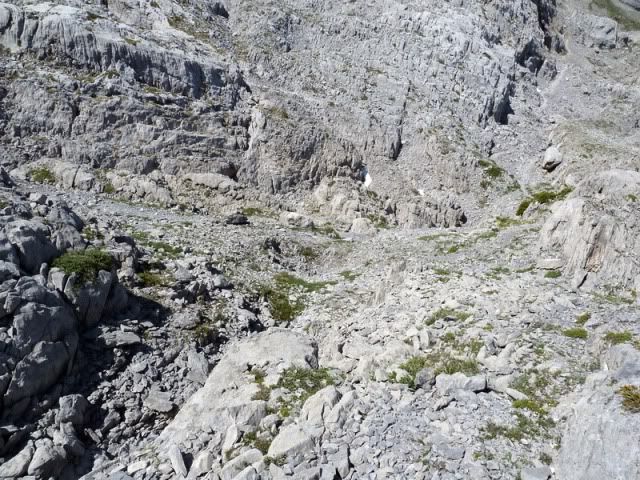
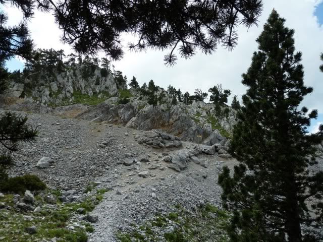
Ya estoy en ella tras media hora de incursiû°n kûÀrstica.
[url=http://s187.photobucket.com/albums/x273/jefoce/2010%20noviembre/?action=view&current=P1010572_resize.jpg]
[/url]
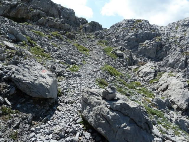
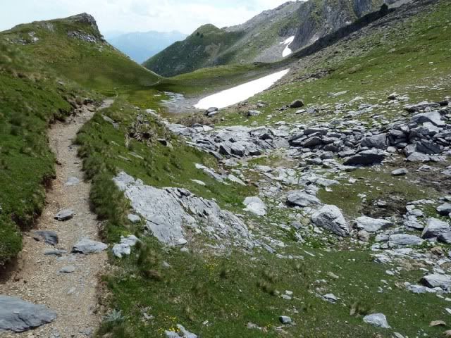
Recorro el sendero balizado hacia el Anie.
[url=http://s187.photobucket.com/albums/x273/jefoce/2010%20noviembre/?action=view&current=P1010575_resize.jpg]
[/url]
[url=http://s187.photobucket.com/albums/x273/jefoce/2010%20noviembre/?action=view&current=P1010576_resize.jpg]
[/url]
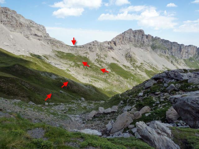
12:20. Col des Anies (2.085m). Veo que a este punto desciende una trocha desde el Soumcouy. Seguramente mejor que mi opciû°n, bastante mûÀs difecta.
[url=http://s187.photobucket.com/albums/x273/jefoce/2010%20noviembre/?action=view&current=P1010578_resize.jpg]
[/url]
Desciendo hacia la vertiente de Lescun.
[url=http://s187.photobucket.com/albums/x273/jefoce/2010%20noviembre/?action=view&current=P1010579_resize.jpg]
[/url]
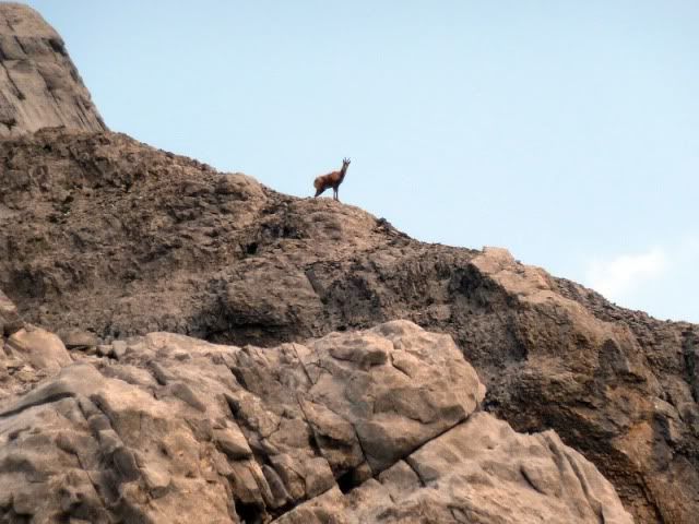
Con algunos que vigilan mis pasos.
[url=http://s187.photobucket.com/albums/x273/jefoce/2010%20noviembre/?action=view&current=P1010580_resize.jpg]
[/url]
[url=http://s187.photobucket.com/albums/x273/jefoce/2010%20noviembre/?action=view&current=P1010582_resize.jpg]
[/url]
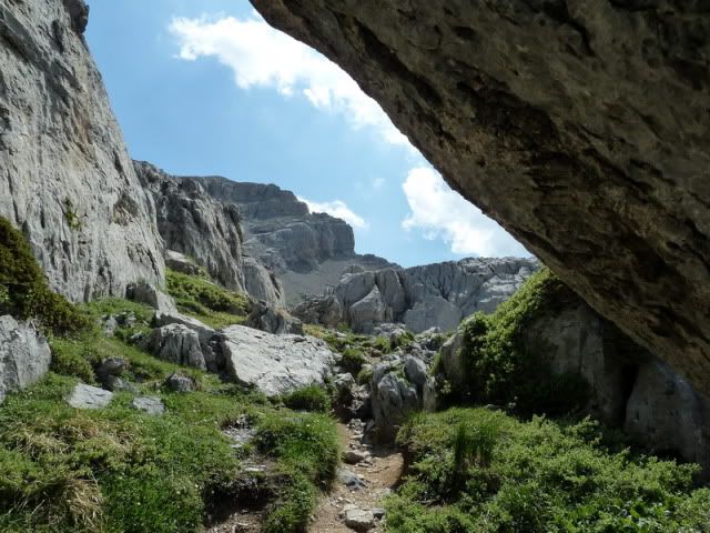
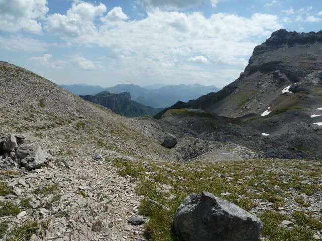
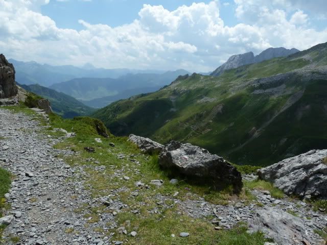
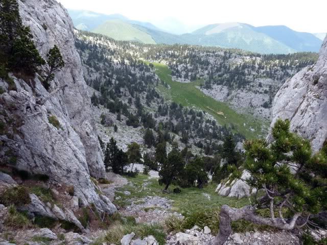
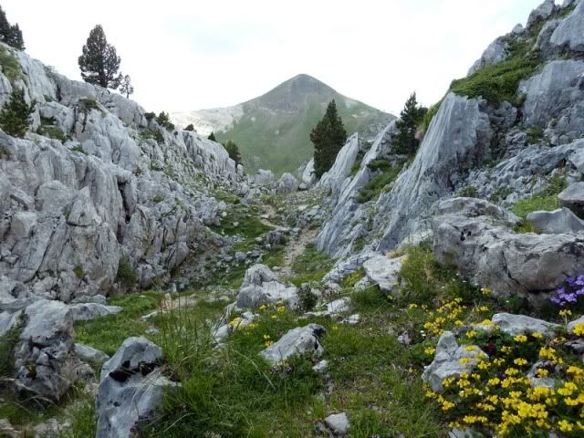
Por fin disfruto de un paisaje mûÀs acorde a esta zona.
[url=http://s187.photobucket.com/albums/x273/jefoce/2010%20noviembre/?action=view&current=P1010583_resize.jpg]
[/url]
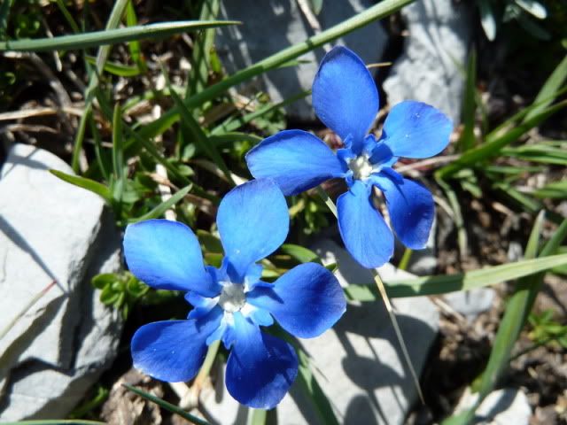
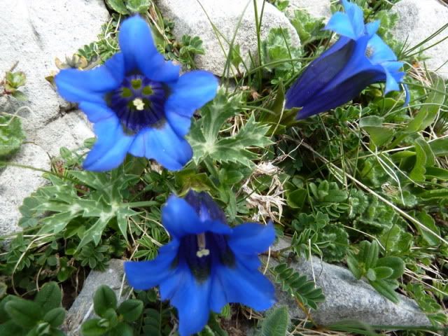
Gencianas.
[url=http://s187.photobucket.com/albums/x273/jefoce/2010%20noviembre/?action=view&current=P1010584_resize.jpg]
[/url]
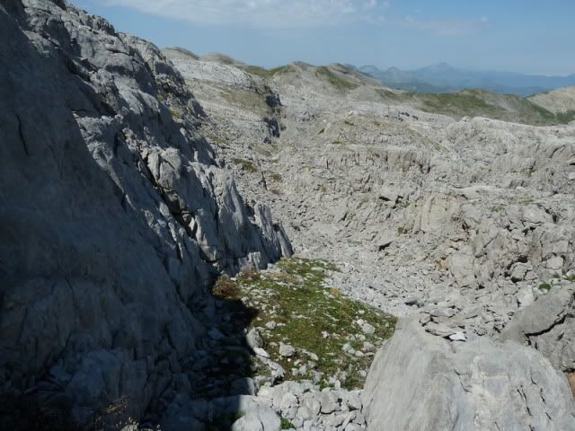
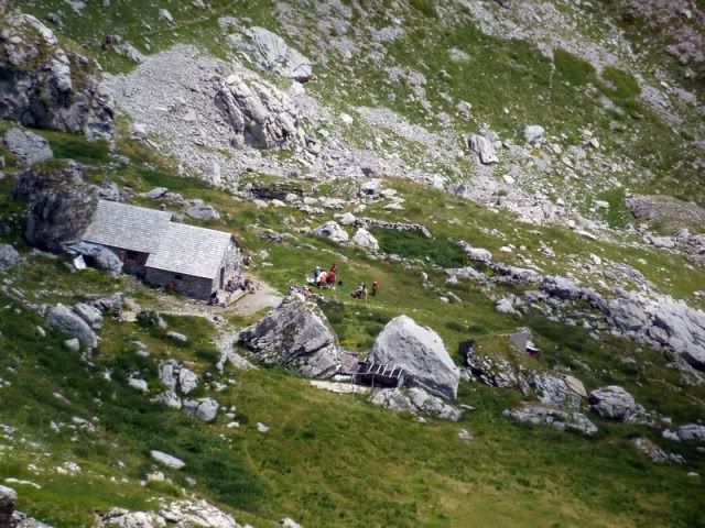
Un remanso de paz.
[url=http://s187.photobucket.com/albums/x273/jefoce/2010%20noviembre/?action=view&current=P1010588_resize.jpg]
[/url]
[url=http://s187.photobucket.com/albums/x273/jefoce/2010%20noviembre/?action=view&current=P1010589_resize.jpg]
[/url]
[url=http://s187.photobucket.com/albums/x273/jefoce/2010%20noviembre/?action=view&current=P1010591_resize.jpg]
[/url]
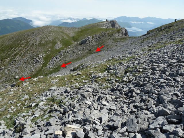
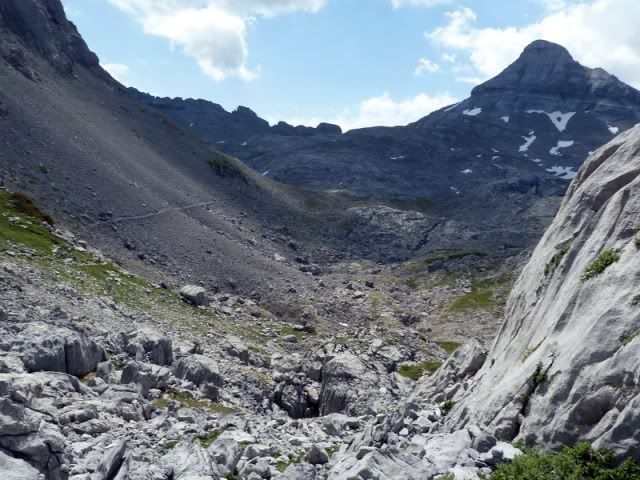
No voy a bajar hasta la cabaûÝa, sino que emprendo una travesûÙa a media ladera para alcanzar el collado entre el Soumcouy y les Tourelles.
[url=http://s187.photobucket.com/albums/x273/jefoce/2010%20noviembre/?action=view&current=p1010593_resizerepor.jpg]
[/url]
[url=http://s187.photobucket.com/albums/x273/jefoce/2010%20noviembre/?action=view&current=P1010595_resize.jpg]
[/url]
[url=http://s187.photobucket.com/albums/x273/jefoce/2010%20noviembre/?action=view&current=P1010597_resize.jpg]
[/url]
[url=http://s187.photobucket.com/albums/x273/jefoce/2010%20noviembre/?action=view&current=P1010600_resize.jpg]
[/url]
Una serie de lazadas me llevan al collado.
[url=http://s187.photobucket.com/albums/x273/jefoce/2010%20noviembre/?action=view&current=P1010601_resize.jpg]
[/url]
[url=http://s187.photobucket.com/albums/x273/jefoce/2010%20noviembre/?action=view&current=P1010602_resize.jpg]
[/url]
[url=http://s187.photobucket.com/albums/x273/jefoce/2010%20noviembre/?action=view&current=pano7_resize.jpg]
[/url]
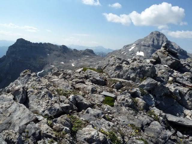
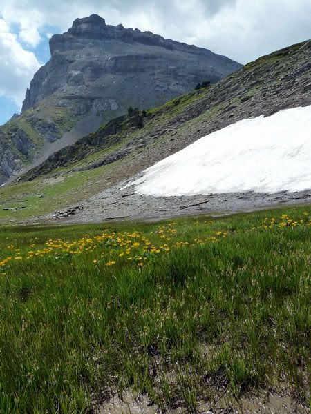
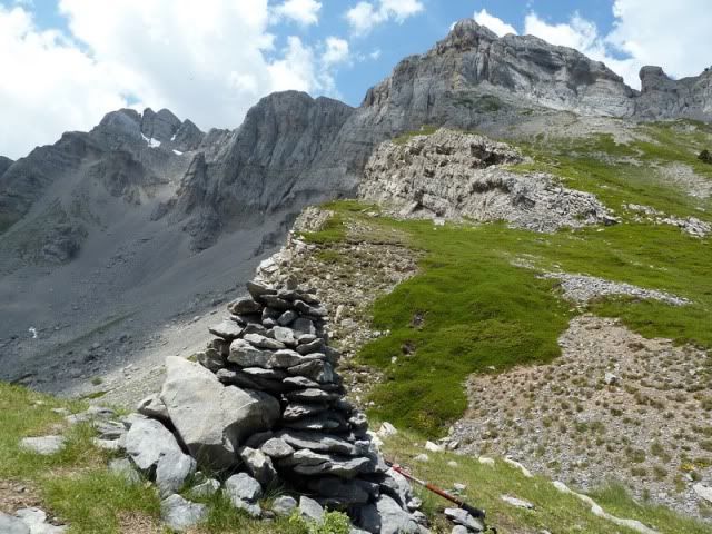
13:27. Pas d'Azuns (1.874m). Un buen lugar para comer.
[url=http://s187.photobucket.com/albums/x273/jefoce/2010%20noviembre/?action=view&current=P1010605_resize.jpg]
[/url]
[url=http://s187.photobucket.com/albums/x273/jefoce/2010%20noviembre/?action=view&current=P1010606_resize.jpg]
[/url]
[url=http://s187.photobucket.com/albums/x273/jefoce/2010%20noviembre/?action=view&current=P1010607_resize.jpg]
[/url]
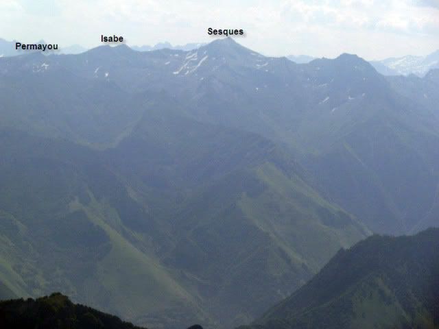
Al este queda el techo de les Orgues de Camplong.
[url=http://s187.photobucket.com/albums/x273/jefoce/2010%20noviembre/?action=view&current=P1010609_resize.jpg]
[/url]
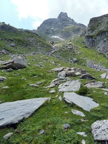
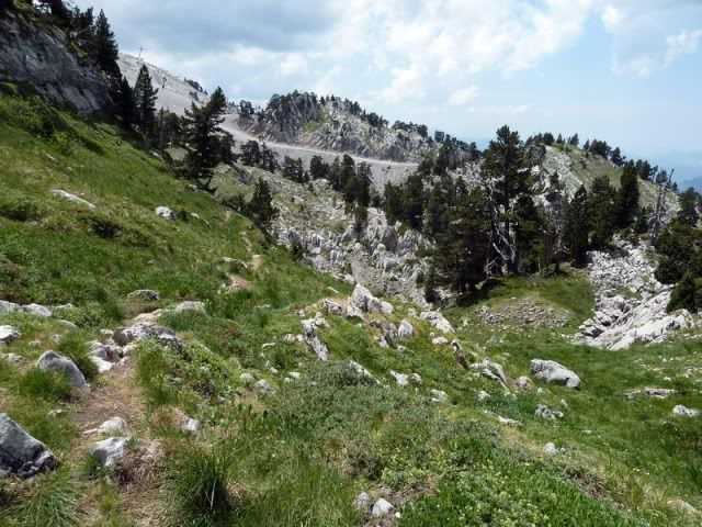
Sigo hacia el sur por terreno sencillo.
[url=http://s187.photobucket.com/albums/x273/jefoce/2010%20noviembre/?action=view&current=P1010608_resize.jpg]
[/url]
Y detengo la vista en el siguiente collado.
[url=http://s187.photobucket.com/albums/x273/jefoce/2010%20noviembre/?action=view&current=p1010611_resizerepor.jpg]
[/url]
Un sendero me llevarûÀ allûÙ.
[url=http://s187.photobucket.com/albums/x273/jefoce/2010%20noviembre/?action=view&current=P1010612_resize.jpg]
[/url]
[url=http://s187.photobucket.com/albums/x273/jefoce/2010%20noviembre/?action=view&current=P1010614_resize.jpg]
[/url]
[url=http://s187.photobucket.com/albums/x273/jefoce/2010%20noviembre/?action=view&current=P1010615_resize.jpg]
[/url]
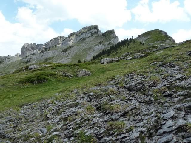
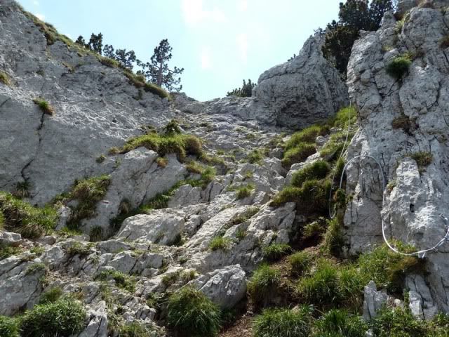
14:10. Pas de l'Osque (1.886m).
[url=http://s187.photobucket.com/albums/x273/jefoce/2010%20noviembre/?action=view&current=pano8_resize.jpg]
[/url]
Sorprende el collado porque el terreno es un tanto aûˋreo. Hay un cable en la otra vertiente.
[url=http://s187.photobucket.com/albums/x273/jefoce/2010%20noviembre/?action=view&current=P1010618_resize.jpg]
[/url]
[url=http://s187.photobucket.com/albums/x273/jefoce/2010%20noviembre/?action=view&current=P1010619_resize.jpg]
[/url]
Siguiendo la GR 10.
[url=http://s187.photobucket.com/albums/x273/jefoce/2010%20noviembre/?action=view&current=P1010621_resize.jpg]
[/url]
[url=http://s187.photobucket.com/albums/x273/jefoce/2010%20noviembre/?action=view&current=P1010622_resize.jpg]
[/url]
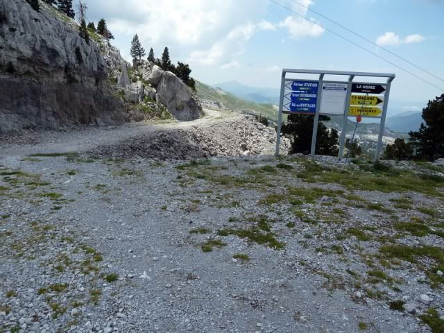
Hasta volver a salir a los dominios de la estaciû°n.
[url=http://s187.photobucket.com/albums/x273/jefoce/2010%20noviembre/?action=view&current=P1010623_resize.jpg]
[/url]
[url=http://s187.photobucket.com/albums/x273/jefoce/2010%20noviembre/?action=view&current=P1010624_resize.jpg]
[/url]
[url=http://s187.photobucket.com/albums/x273/jefoce/2010%20noviembre/?action=view&current=P1010625_resize.jpg]
[/url]
[url=http://s187.photobucket.com/albums/x273/jefoce/2010%20noviembre/?action=view&current=P1010626_resize.jpg]
[/url]
AquûÙ seguimos por la GR 10.
[url=http://s187.photobucket.com/albums/x273/jefoce/2010%20noviembre/?action=view&current=p1010627_resizerepor.jpg]
[/url]
[url=http://s187.photobucket.com/albums/x273/jefoce/2010%20noviembre/?action=view&current=P1010629_resize.jpg]
[/url]
[url=http://s187.photobucket.com/albums/x273/jefoce/2010%20noviembre/?action=view&current=P1010631_resize.jpg]
[/url]
Ya por terreno conocido.
[url=http://s187.photobucket.com/albums/x273/jefoce/2010%20noviembre/?action=view&current=P1010632_resize.jpg]
[/url]
Anie.
[url=http://s187.photobucket.com/albums/x273/jefoce/2010%20noviembre/?action=view&current=P1010633_resize.jpg]
[/url]
Ya estoy cerca.
[url=http://s187.photobucket.com/albums/x273/jefoce/2010%20noviembre/?action=view&current=P1010634_resize.jpg]
[/url]
Fin de la circular.
[url=http://s187.photobucket.com/albums/x273/jefoce/2010%20noviembre/?action=view&current=P1010635_resize.jpg]
[/url]
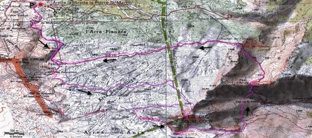
Y os dejo el mapa.
[url=http://s187.photobucket.com/albums/x273/jefoce/2010%20noviembre/?action=view&current=Soumcouy-1.jpg]
[/url]
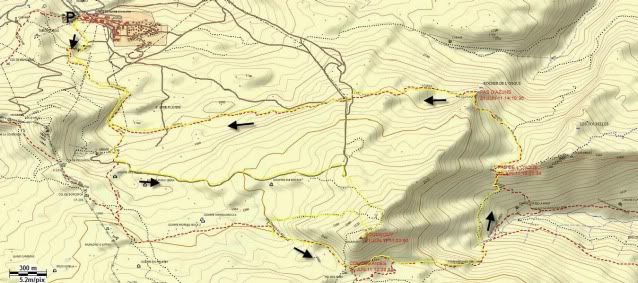
Y os dejo el mapa de Topopiris.
[url=http://s187.photobucket.com/albums/x273/jefoce/2010%20noviembre/?action=view&current=Soumcouy3D.jpg]
[/url]
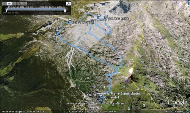
Y os dejo la imagen 3D del Google Earth.
[url=http://s187.photobucket.com/albums/x273/jefoce/2010%20noviembre/?action=view&current=soumcouy-2.jpg]
[/url]
Y os dejo el perfil.
[url=http://s187.photobucket.com/albums/x273/jefoce/2010%20noviembre/?action=view&current=Soumcouy.png]
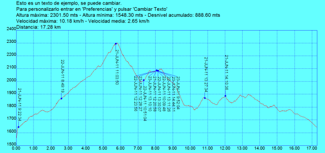
[/url]
Y en wikiloc os dejo el track:
ver trackLAS NOTAS (La escala es del 1 al 5):
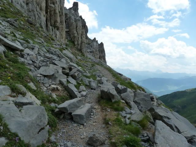
DIFICULTAD: 4. Una ruta con dos partes bien diferenciadas. La subida es sencilla, apta para todos los pû¤blicos, pero el descenso es peliagudo. Muchos tramos kûÀrsticos. Se acaba haciendo dura.
BELLEZA DEL ITINERARIO: 4. Una jornada en la que se aprecia el contraste. Ir de menos a mûÀs es lo que le da brillo.
IMPORTANCIA DE LA CUMBRE: 4.
Para que vean que el Soumcouy no sû°lo se puede subir cuando tiene nieve. ContinuarûÀ...